ORLANDO, Fla. — Severe Weather Center 9 is monitoring two new areas of interest in the tropics.
The first one is over the western Bahamas close to Florida. A frontal boundary is expected to lift into this region late week.
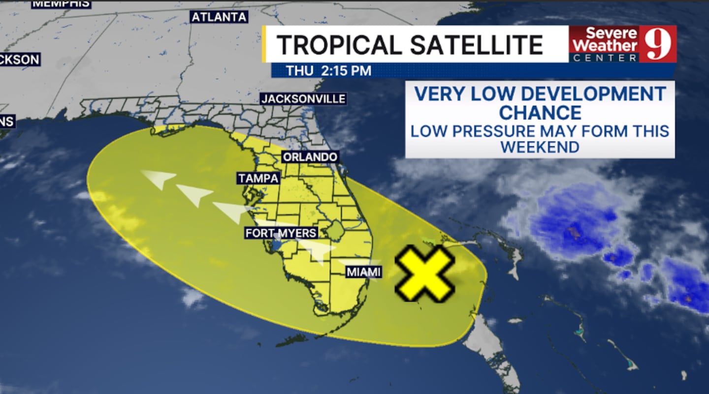
An area of low pressure may form this weekend and could attempt to organize further as it moves northwestward. This currently has a very low development chance with conditions not favorable for organization.
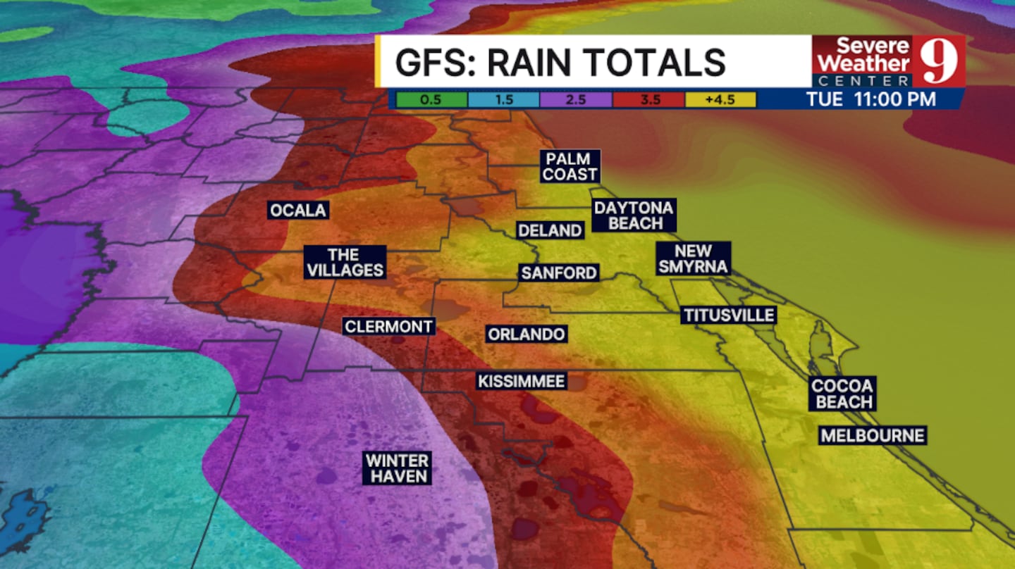
Regardless of development, heavy rainfall will be a concern this weekend into next week across much of the state, including Central Florida.
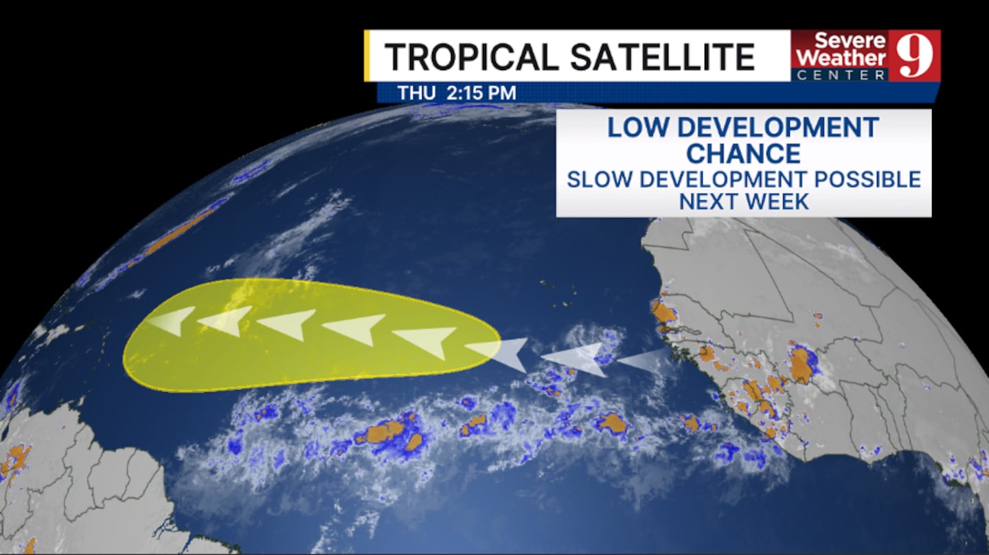
Elsewhere, a tropical wave will float off the coast of Africa this weekend.
As the wave moves westward, it may develop further in the open waters of the Atlantic. This has a low development chance.
If it were to develop, it would likely turn northwestward, away from Florida.
Stay with Severe Weather Center 9 for the latest on the tropics all season long.
Click here to download our free news, weather and smart TV apps. And click here to stream Channel 9 Eyewitness News live.

©2025 Cox Media Group