ORLANDO, Fla. — It’s an active start to the weekend, and more unsettled weather is likely for Mother’s Day.
The rain and storms will wind down later this evening, and an isolated strong storm will be possible. Overnight lows will be in the low 70s.
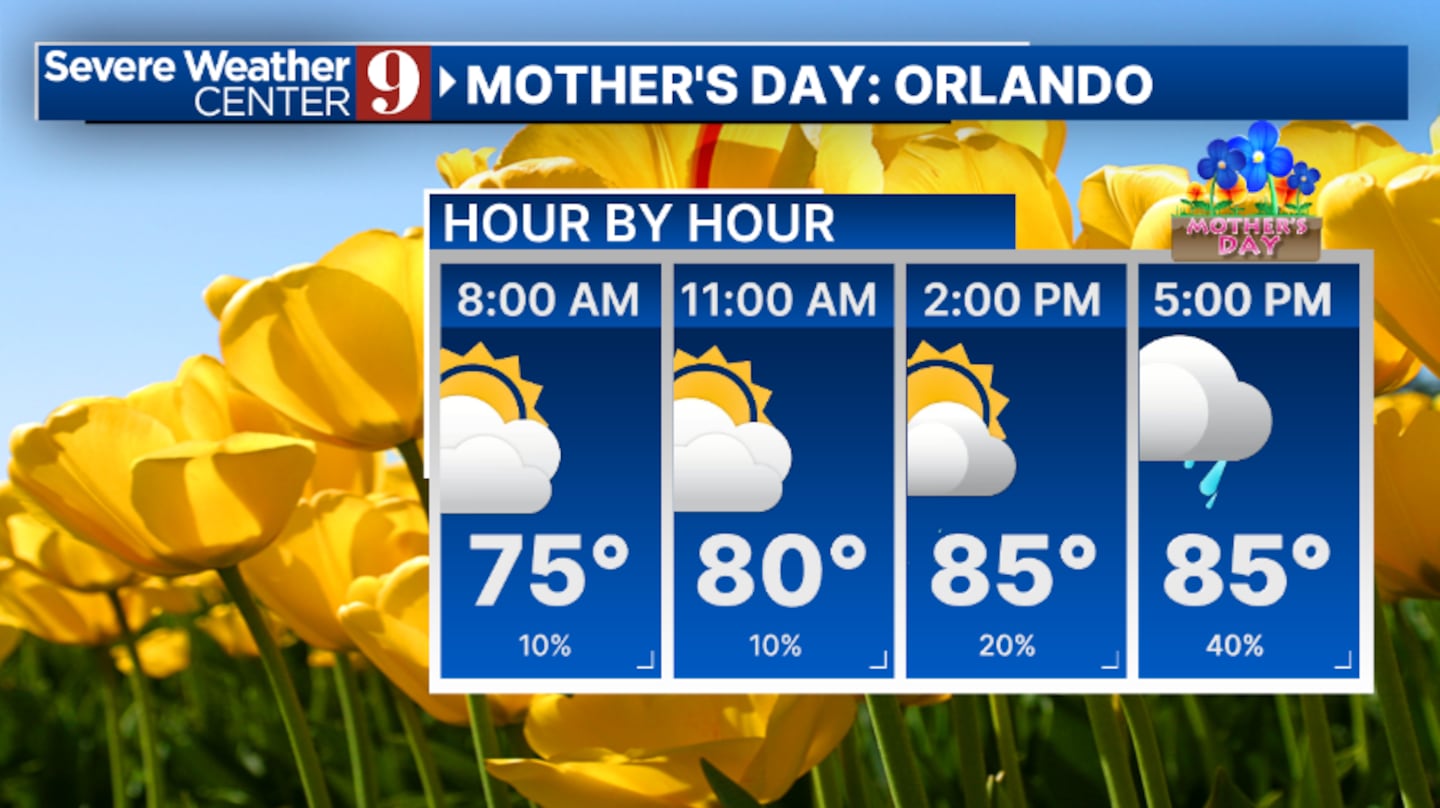
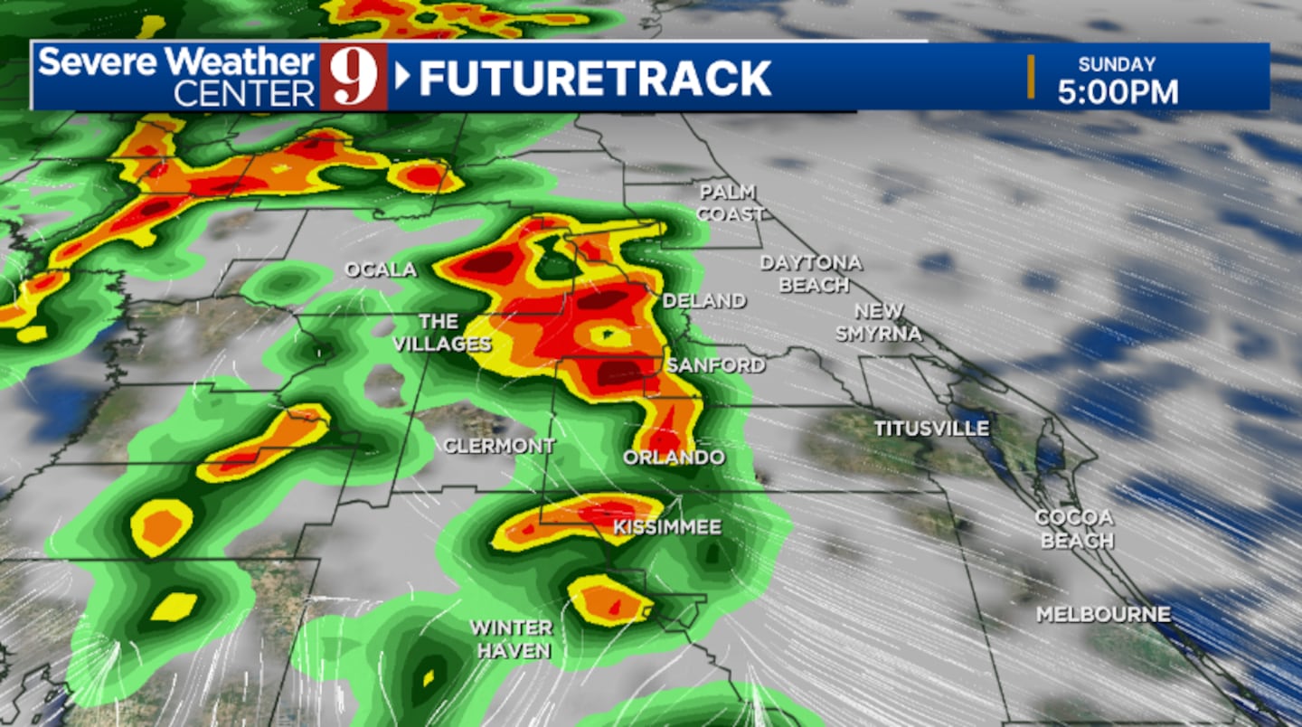
More storms are likely for Mother’s Day. A few showers will be possible in the morning, but the higher rain and storm chances will be in the PM hours. A few storms could again be strong, with highs in the upper 80s.
A Weather Alert Day is in effect for Monday, as a cold front approaches the area. Rounds of rain and storms are likely, with the worst activity in the afternoon and evening hours. Some storms could be strong to severe, with highs in the low 80s.
The cold front sweeps through early Tuesday, bringing calmer conditions back to the area. Skies will clear on Tuesday, with highs in the mid 80s.
Plenty of sunshine is expected for the middle of next week, along with dry conditions. Highs will be in the upper 80s and low 90s.
Our warmest air of the season will likely arrive late next week, with highs soaring into the mid 90s.
Stay with Severe Weather Center 9 for the latest on the storm threat this weekend and on Monday.
Click here to download our free news, weather and smart TV apps. And click here to stream Channel 9 Eyewitness News live.

©2025 Cox Media Group