
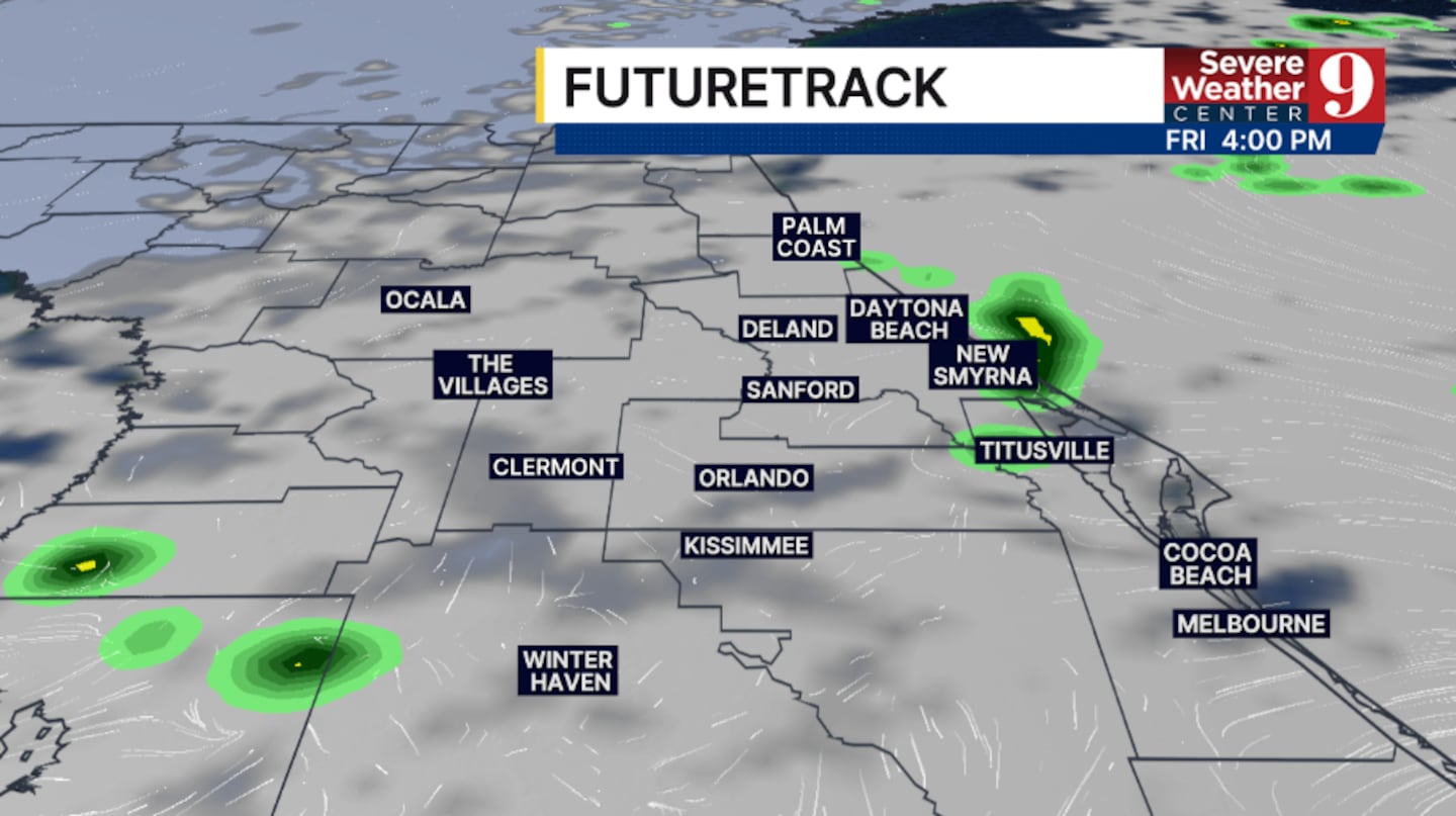
ORLANDO, Fla. — It’s been a cloudy Thursday across Central Florida, and more clouds and a few showers are likely on Friday.
The clouds will remain in place tonight, with a few showers possible south of Orlando. Expect morning lows to be in the mid-60s.
Increasing moisture pushes in for Friday. We’ll see partly sunny skies once again, with a few isolated showers possible. Most will stay dry, with temps in the low 80s.
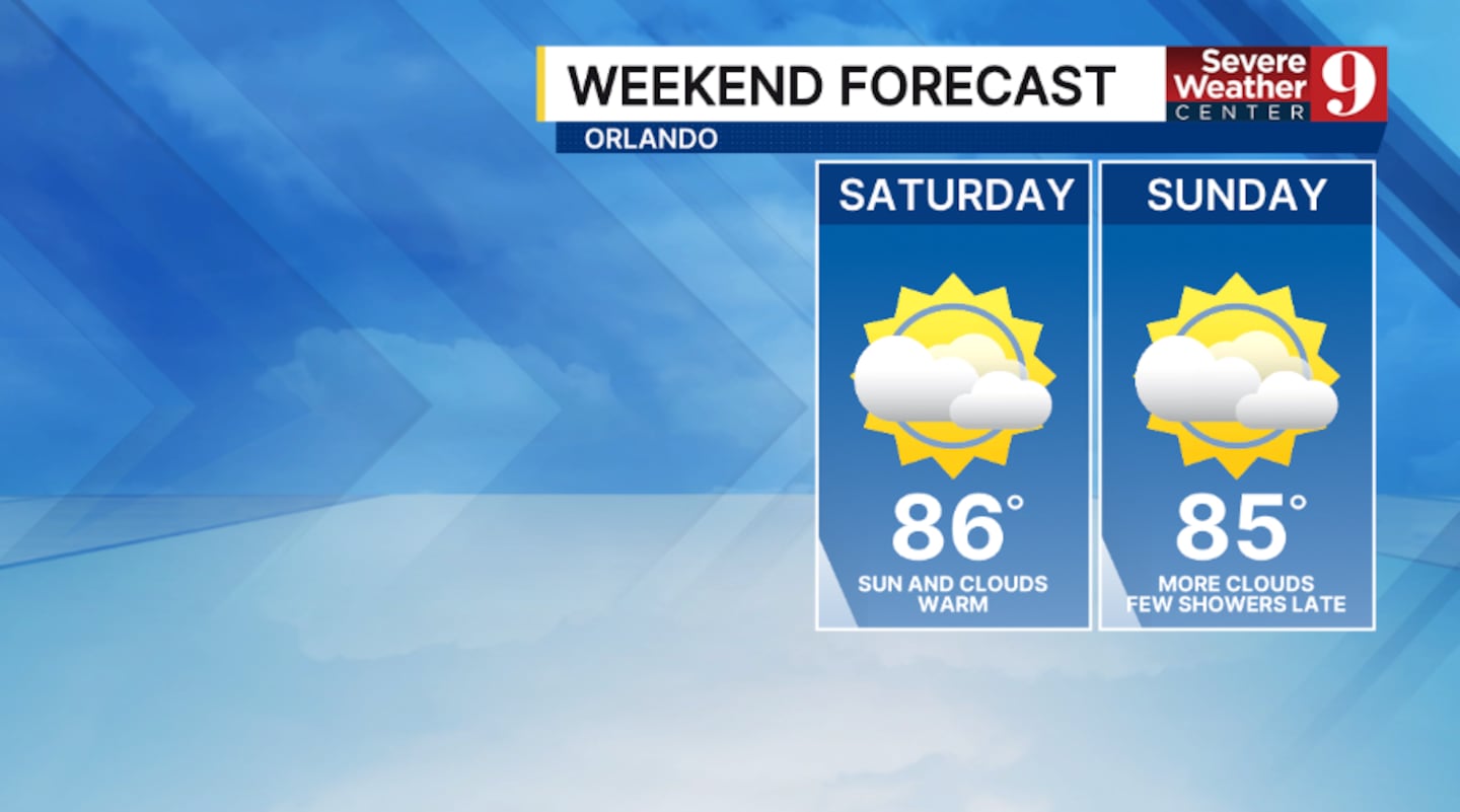
Drier weather returns for Saturday. A blend of sun and clouds is expected, with temperatures expected to warm quickly. Highs for Saturday are expected to be in the mid-80s.
A strong cold front approaches the region on Sunday. This could result in a few scattered showers, but most areas will remain dry. Temps to close out the weekend will be in the mid-80s.
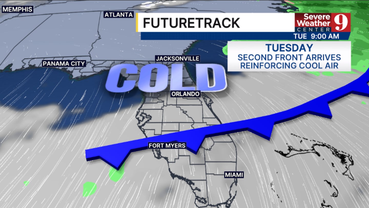
Behind the front, the coldest air of the season arrives to start next week. Monday will feature temps only in the upper 60s, with morning lows on Tuesday tumbling into the low 40s.
Some Wind Chill Advisories may be possible, as temperatures could feel like the 20s and 30s on Tuesday morning.
Click here to download our free news, weather and smart TV apps. And click here to stream Channel 9 Eyewitness News live.

©2025 Cox Media Group


