
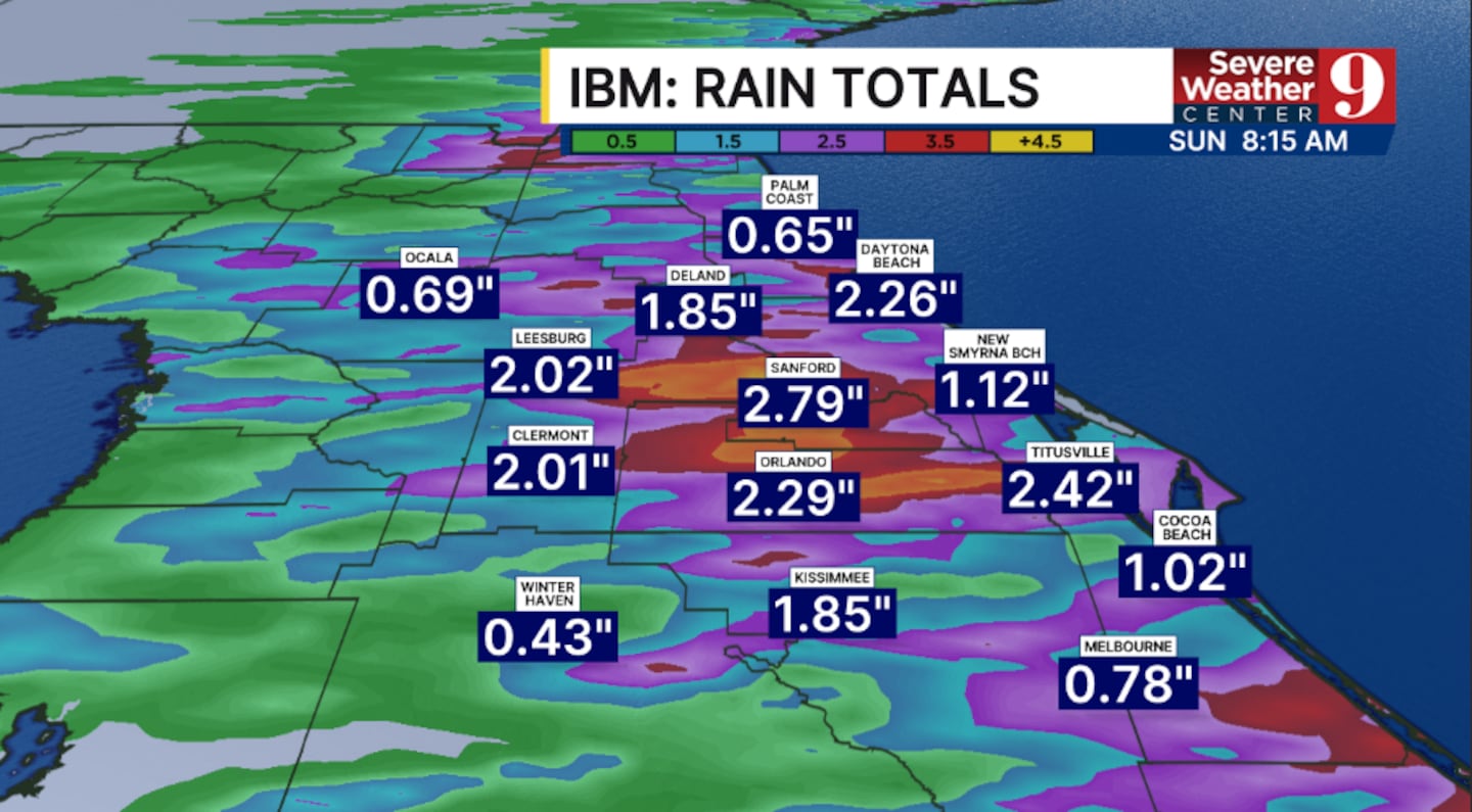
ORLANDO, Fla. — A flood watch has been issued for part of the coastline as the threat for heavy rainfall increases over the next several days. It is expected to expire Sunday morning.
Just a few showers are possible Thursday evening, but rain may again move in from the Atlantic overnight. Morning lows will be in the low 70s.
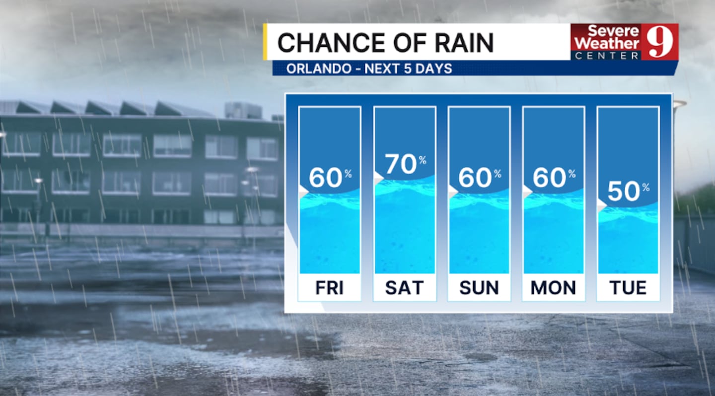
Scattered showers and storms are again likely for Friday. The best chance for activity will likely be in the morning and midday hours, with temps in the mid-80s.
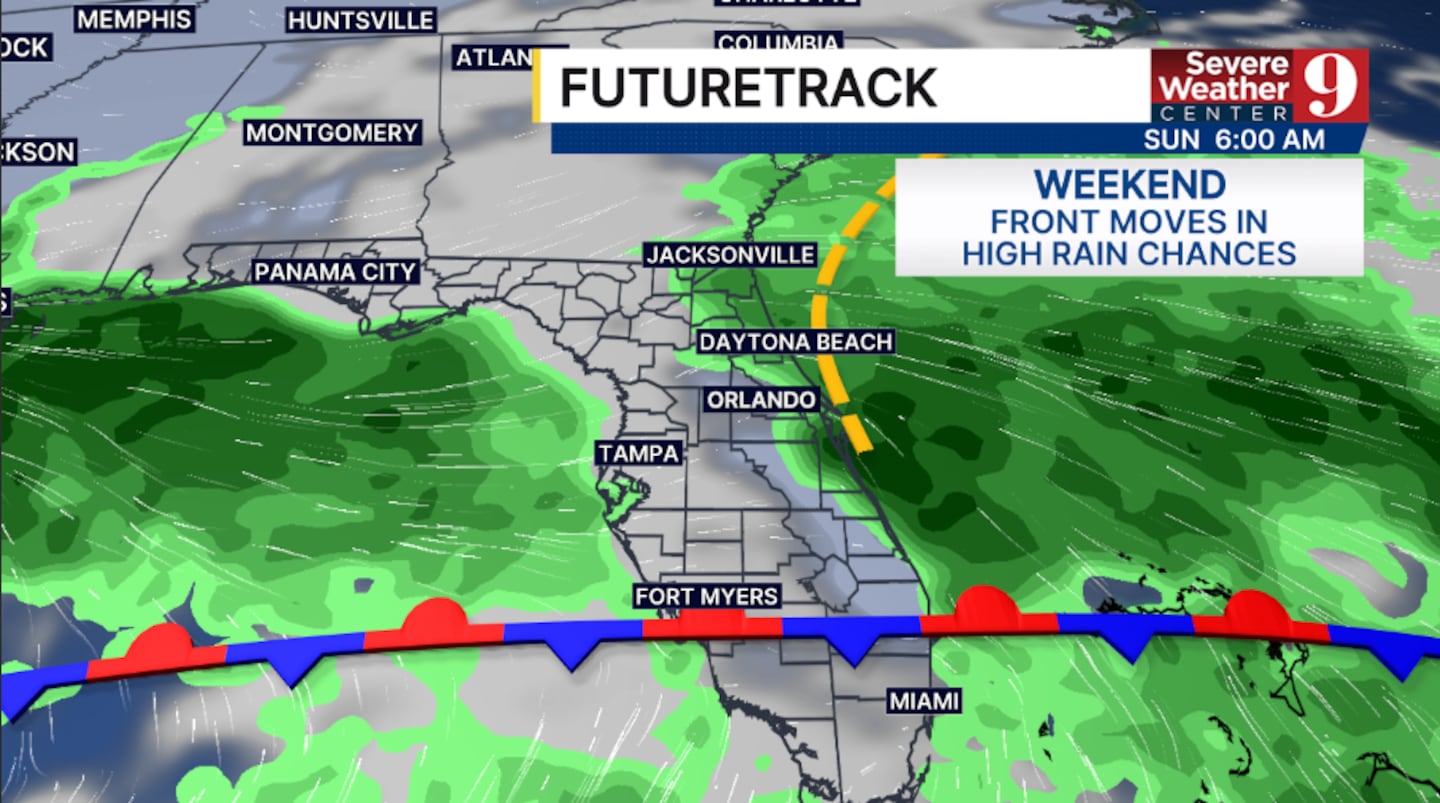
Even more moisture moves in for the weekend, increasing rain chances further. Expect periods of rain on Saturday, with temperatures only in the low 80s. Heavy rainfall will also be possible.
The elevated rain and storm chances will continue into Sunday, but coverage may a little lower. Highs to close out the weekend will be in the mid-80s.
More rain and storms are likely for much of next week, with some potential drying by the back end of next week.
Stay with Severe Weather Center 9 for the latest on the flooding threat in the coming days.
Click here to download our free news, weather and smart TV apps. And click here to stream Channel 9 Eyewitness News live.

©2025 Cox Media Group


