ORLANDO, Fla. — Tropical Storm Erin continues to move westward in the open Atlantic and is on track to become a hurricane late week.
11:10 a.m. update:
The 11 a.m. advisory from the National Hurricane Center indicates maximum winds with Erin are still at 45 mph.
Erin is expected to gradually strengthen later Thursday, and the system is expected to become a hurricane on Friday.
The storm is expected to continue to move westward, then slowly turn to the west-northwest into the weekend.
Erin will likely move near or just north of the northern Lesser Antilles this weekend.
Interests in the northern Lesser Antilles, the Virgin Islands and Puerto Rico should monitor the progress of Erin.
Long-term, Erin is expected to eventually turn to the north and could impact Bermuda next week.
The forecast cone has shifted slightly to the west, but is expected to stay well to the east of Florida.
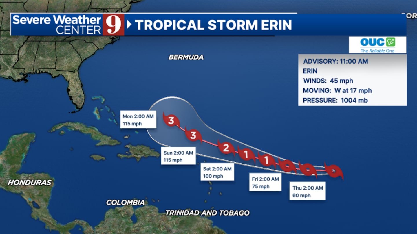
The east coast of the state will likely deal with large swells and dangerous rip currents early next week from the system.
Erin is the fifth named storm of the Atlantic hurricane season and is scheduled to be the first hurricane of the season.
Stay with Severe Weather Center 9 for the latest on the tropics.
Original report:
Tropical Storm Erin is likely to become the first hurricane of the 2025 season by late Thursday or early Friday.
The storm is expected to pass near the northern Leeward Islands, Virgin Islands, and Puerto Rico over the weekend, bringing dangerous waves to the northern side of these islands.
Tropical storm conditions are possible in the affected areas, depending on how close Erin passes to the islands.
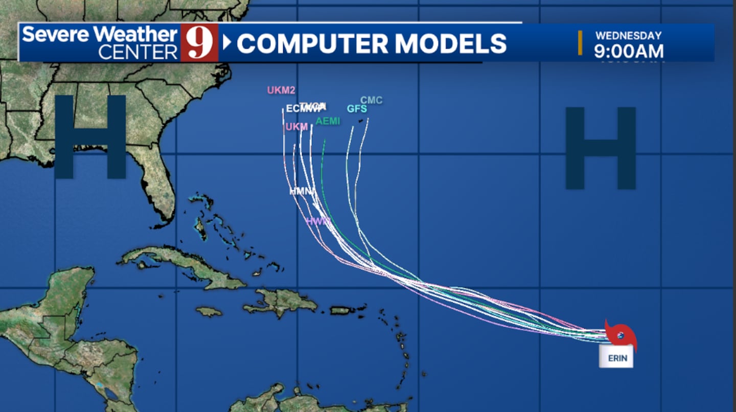
Models suggest that Erin will turn north as it approaches the Bahamas, which would keep it away from Florida’s east coast.
If Erin stays on its current track, large swells and dangerous rip currents could affect Florida’s east coast early next week.
The situation remains fluid, and officials continue to monitor Erin closely for any shifts or changes in its path.
Click here to download our free news, weather and smart TV apps. And click here to stream Channel 9 Eyewitness News live.

©2025 Cox Media Group


