ORLANDO, Fla. — Central Florida will see a typical mid-August weather pattern on Monday.
Our area will see afternoon highs reaching the upper 80s to low 90s and a 40% chance of sea breeze showers and storms.
As the week progresses, drier conditions are expected on Tuesday and Wednesday while temperatures remain in the low 90s.
Meanwhile, wave heights will increase, and rip currents will pose a danger along the coast.
Hurricane Erin, which is expected to stay hundreds of miles off the East Coast, will influence the weather pattern.
Despite its distance, Erin will contribute to the highest surf expected from late Tuesday to early Thursday.
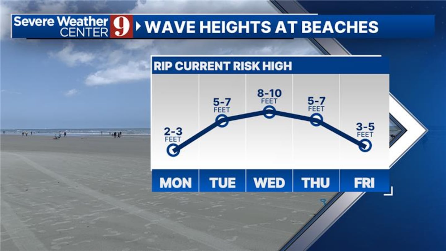
Residents and visitors are advised to exercise caution near the water due to the dangerous rip currents expected throughout the week.
Click here to download our free news, weather and smart TV apps. And click here to stream Channel 9 Eyewitness News live.

©2025 Cox Media Group


