ORLANDO, Fla. — It’ll be a dry and warm start to your Wednesday in Central Florida.
Hot and sticky conditions will take over again in the afternoon.
Highs will reach the upper 80s and low 90s.
You can also expect scattered showers and isolated thunderstorms to return Wednesday.
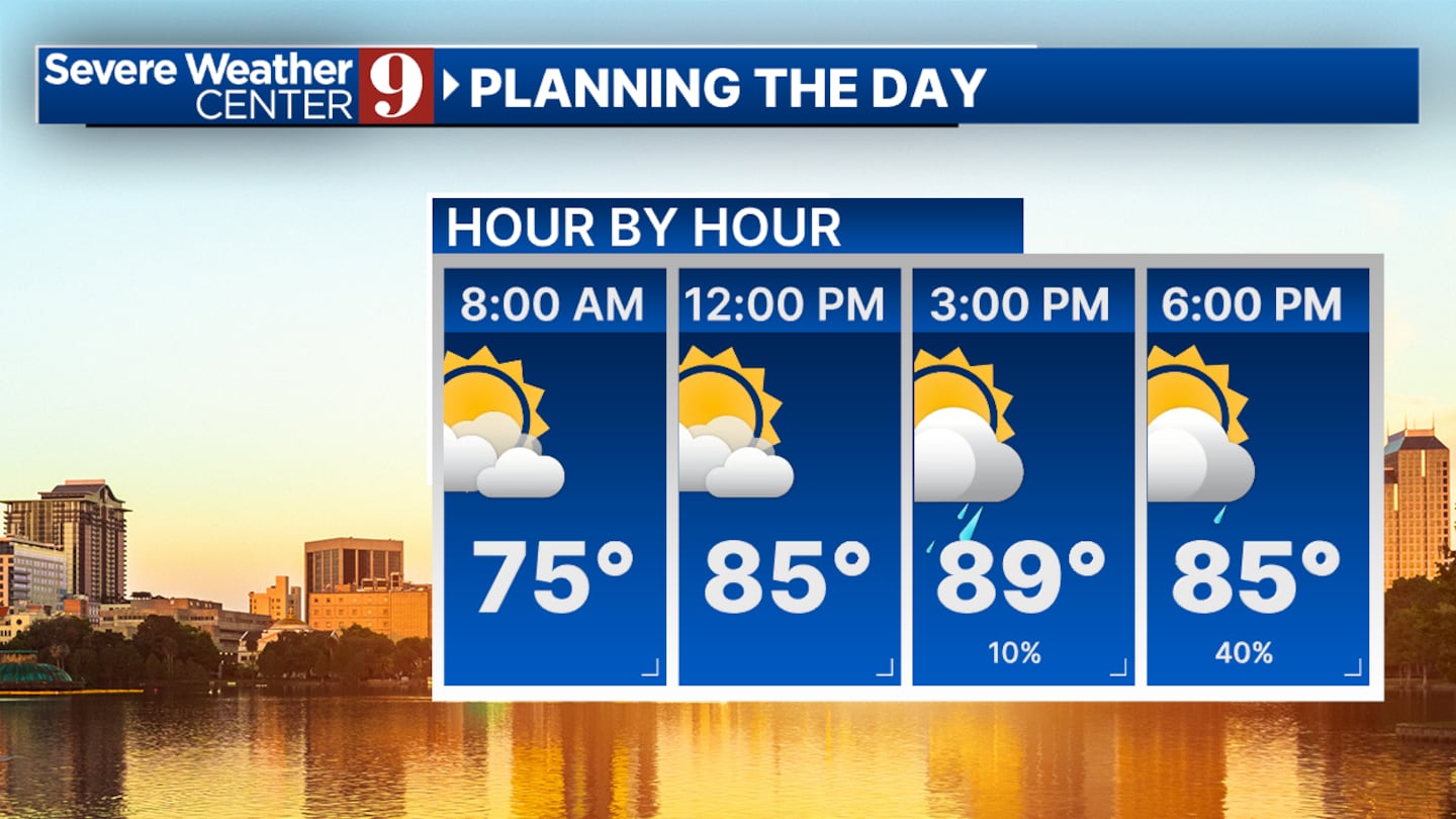
They’ll be more widespread in coverage and are most likely to happen from 2 p.m. to 9 p.m., according to meteorologist Kassandra Crimi.
Isolated downpours will bring an inch or more of rain for a few communities. Isolated strong storms can’t be ruled out, bringing possible wind gusts between 40-50 mph, hail, and lightning.
Looking ahead to the remainder of the work week and into the weekend, widely scattered showers and storms will be possible.
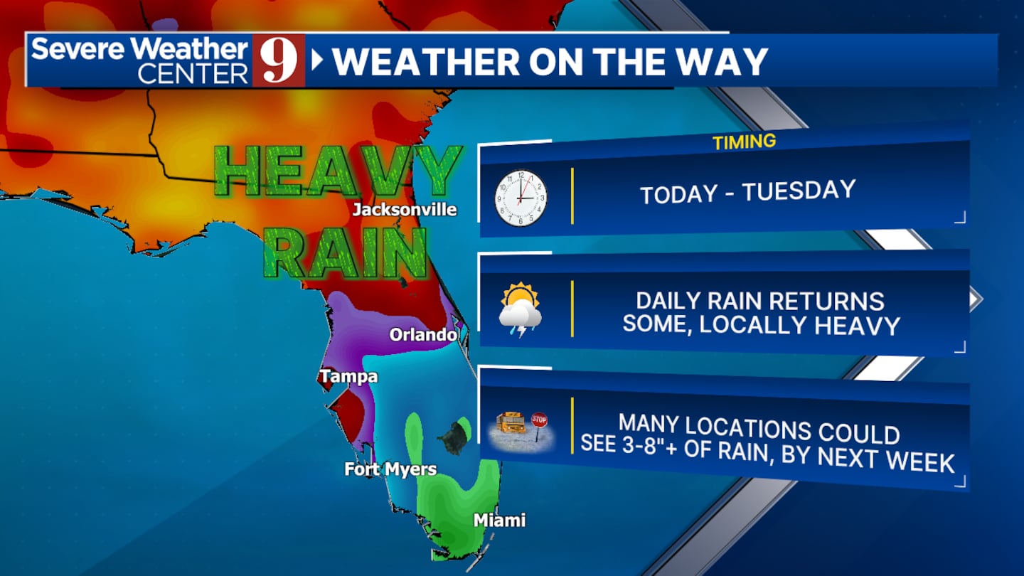
Much of the drought-ridden area of Central Florida will see some much-needed rainfall.
In fact, over the next 7 days, parts of the Channel 9 viewing area could pick up as much as 3 to 8 inches of rain.
Follow our Severe Weather team on X for updates:
Click here to download our free news, weather and smart TV apps. And click here to stream Channel 9 Eyewitness News live.

©2025 Cox Media Group