
UPDATE:
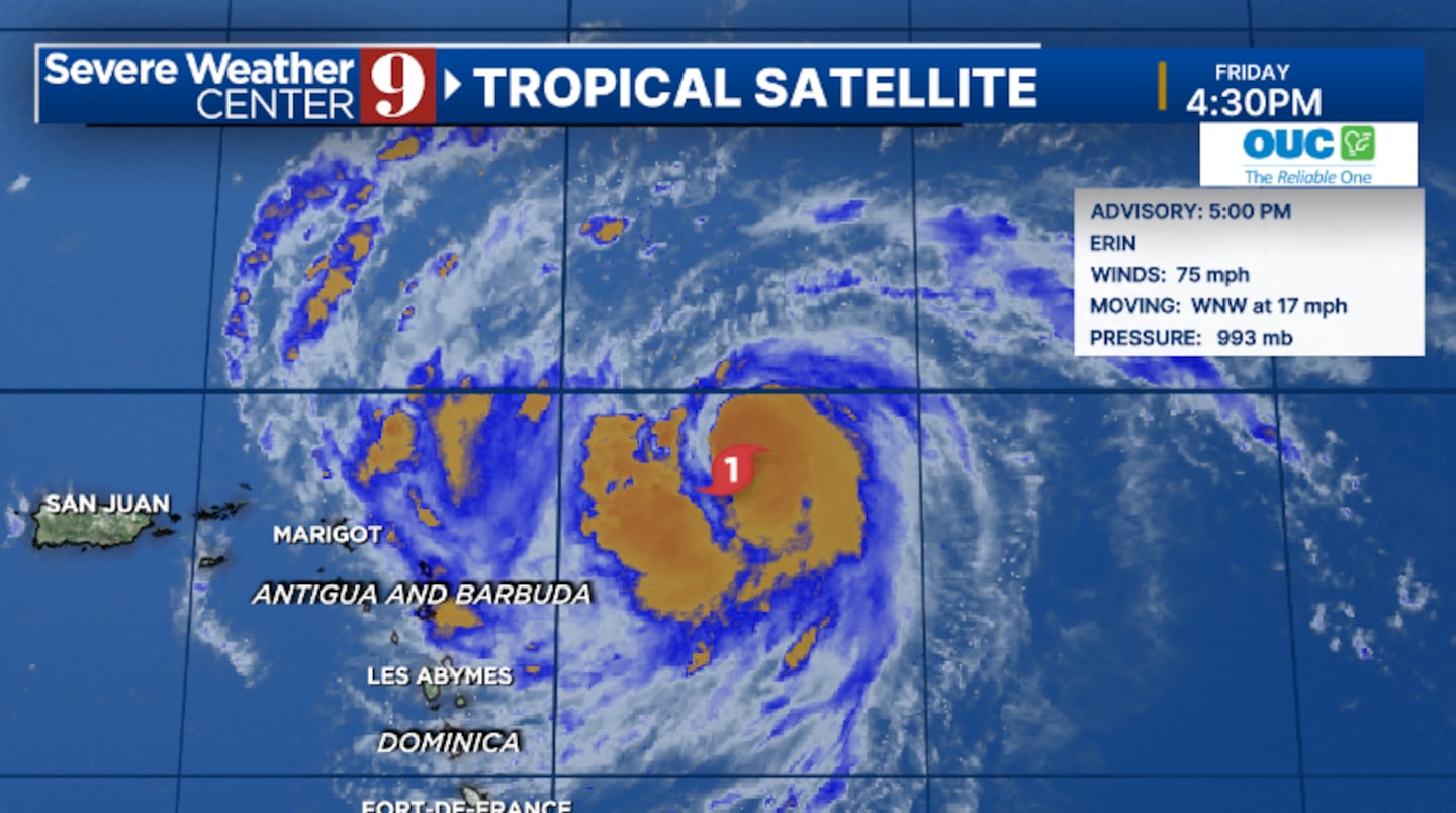
ORLANDO, Fla. — NOAA Hurricane Hunter aircraft have maximum sustained winds of 85 mph at 8 pm. It remains a Category 1 hurricane.
Tropical Storm Watches have also been issued for Barbuda.
PREVIOUS STORY
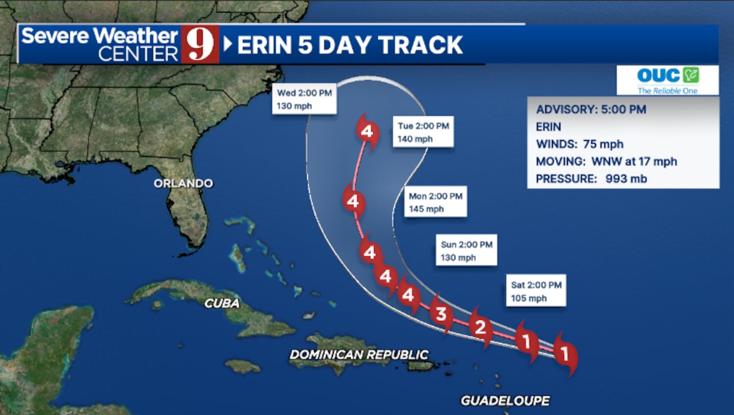
Hurricane Erin remain a Category 2 storm Friday evening and is expected to rapidly intensify this weekend.
The 5 pm advisory from the National Hurricane Center has winds with Erin of 75 mph, making it a Category 1 storm.
Tropical Storm Watches remain in effect for the northern Lesser Antilles.
Erin became the first hurricane in the 2025 Atlantic basin Friday morning.
Steady to rapid strengthening through the weekend, and Erin is expected to become a major hurricane.
The storm is expected to continue to move west-northward the next few days.
Erin is likely to move just north of the northern Lesser Antilles, the Virgin Islands and Puerto Rico this weekend.
Long-term, Erin is expected to eventually turn to the north and will likely pass between the east coast of the United States and Bermuda next week.
Erin is still expected to stay well east of Florida as it makes a northward turn.
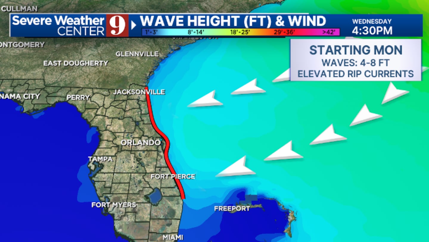
The east coast of the state will likely deal with large swells of 4 to 8 feet and dangerous rip currents early next week from the system.
Dry air will also likely push into Florida, reducing storm chances for the middle of next week.
Stay with Severe Weather Center 9 for the latest on Erin.
Click here to download our free news, weather and smart TV apps. And click here to stream Channel 9 Eyewitness News live.

©2025 Cox Media Group


