ORLANDO, Fla. — Hurricane Erin is raging through the western Atlantic on Monday as a powerful Category 4 storm.
Erin currently has winds reaching 130 mph, is moving northwest at 13 mph.
The hurricane is threatening the Turks and Caicos and the southern Bahamas with severe weather on Monday. Erin is expected to bring heavy winds and rain to these areas throughout the day.
By Tuesday and Wednesday, Hurricane Erin is forecasted to turn north, remaining hundreds of miles away from the U.S. East Coast.
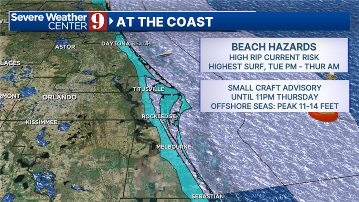
However, the storm will generate large swells, leading to dangerous rip currents and potential minor beach and dune erosion along local beaches.
In addition to Hurricane Erin, meteorologists are closely monitoring another tropical wave that has emerged in the Atlantic.
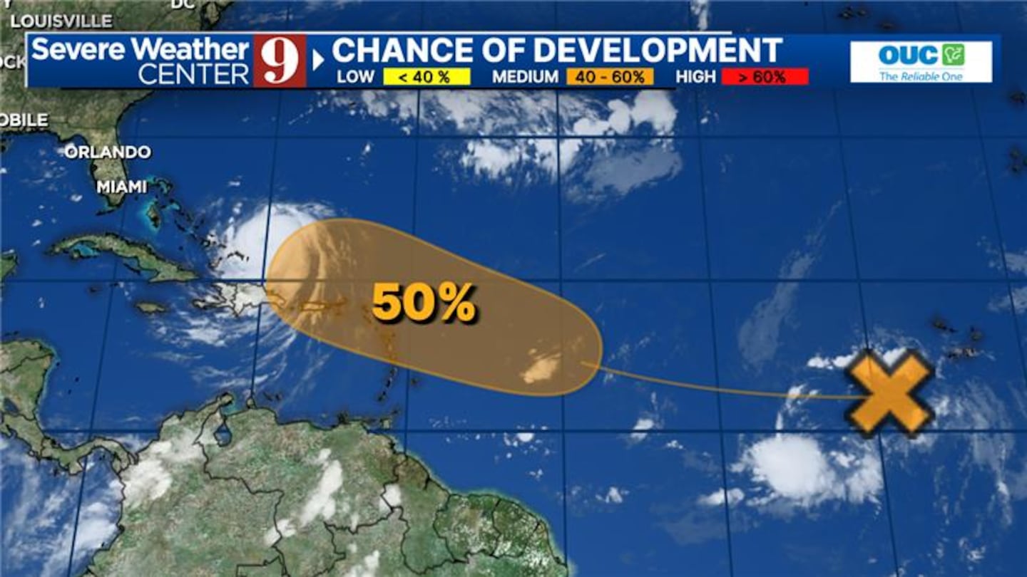
This system is approaching the Leeward Islands and has a 50% chance of developing into a tropical storm by the end of the week.
The next name on the list for tropical storms this season is Fernand, should the wave develop further.
Residents along the East Coast are advised to stay informed about the potential impacts of Hurricane Erin, particularly concerning surf conditions and beach erosion.
Click here to download our free news, weather and smart TV apps. And click here to stream Channel 9 Eyewitness News live.

©2025 Cox Media Group


