ORLANDO, Fla. — After what turned into an active Sunday, more rain is likely to start the work week.
The scattered showers and storms will fade away this evening, but activity may linger along the coast overnight. Some minor flooding will also be a concern, with lows in the low 70s.
More rain and storms are likely on Monday as a storm system pushes through the area. Just like Sunday, a washout is not expected with warm temperatures in the mid-80s.
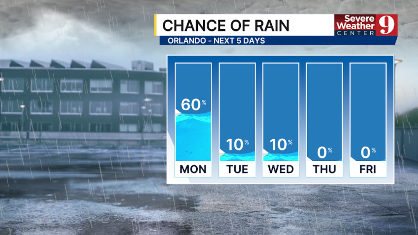
Behind the system, cooler and drier air moves in for Tuesday. A few light showers will remain possible at the coast, with temperatures on Tuesday in the low 80s.
A strong cold front will push in on Wednesday. A stray sprinkle will be possible, but most of the area will stay dry. Highs on Wednesday will be in the low 80s.
Behind the front, the coolest air of the season rushes in with temps in the low 70s and dry conditions.
The pleasant weather is expected to continue into Halloween.
Click here to download our free news, weather and smart TV apps. And click here to stream Channel 9 Eyewitness News live.

©2025 Cox Media Group