
ORLANDO, Fla. — It’s yet another warm start to the day, but rain chances have returned to the forecast for Sunday.
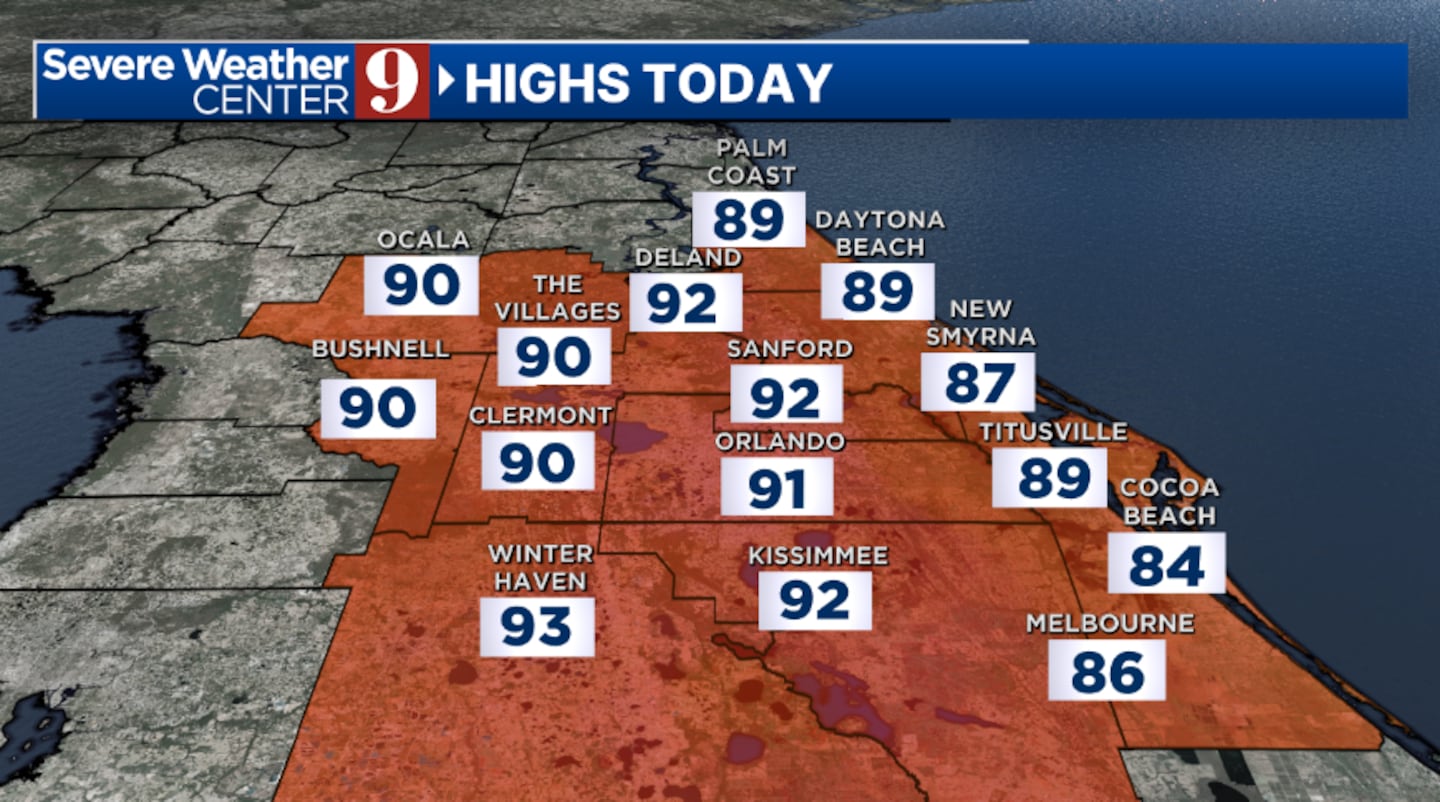
A very stray shower will be possible in inland areas later today, but the vast majority of the area will stay dry. Sunday’s highs will again climb into the low 90s.
Any shower activity will fade away later tonight, with just a few clouds remaining. Morning lows will be in the upper 60s.
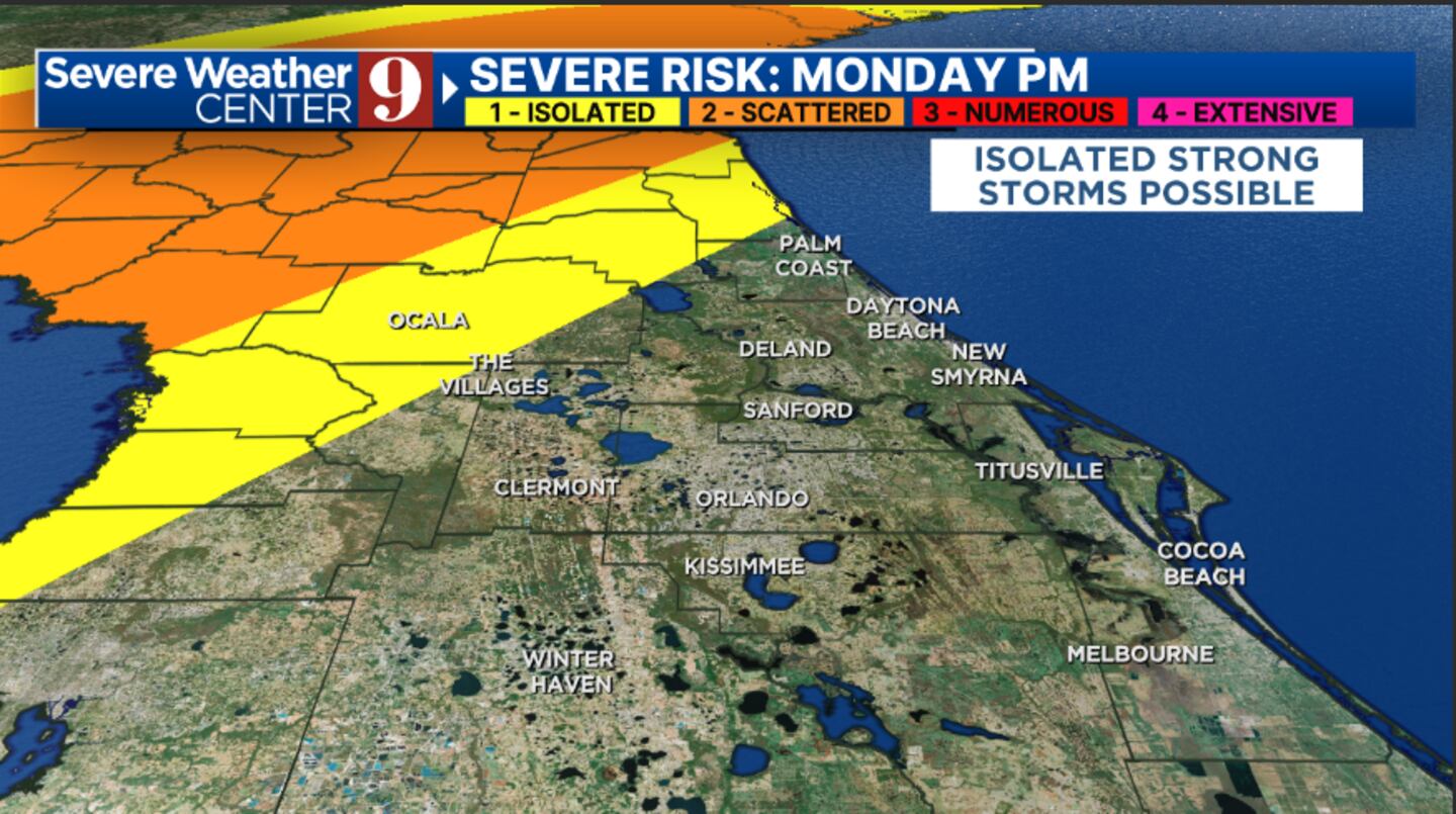
Rain and storm chances increase further to start the work week. We’ll see higher coverage of PM showers and storms on Monday, with highs again in the low 90s.
Big changes arrive Monday night into Tuesday. A strong cold front will sweep through the area, bringing the best chance for rain and storms across the area.
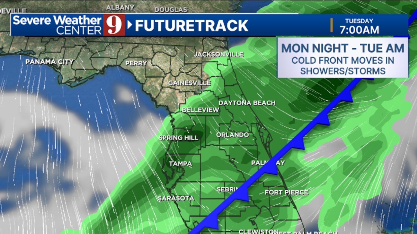
A few storms may be strong northwest of Orlando on Monday evening. The rain will exit in the PM hours on Tuesday, with cooler highs in the mid-70s.
Much cooler air continues for midweek. Wednesday and Thursday, with temperatures in the low 80s, a few scattered showers will be possible.
A second cold front moves in late Friday, bringing a few showers into the area. Temps to close out the work week will be in the mid-80s.
Click here to download our free news, weather and smart TV apps. And click here to stream Channel 9 Eyewitness News live.

©2025 Cox Media Group


