
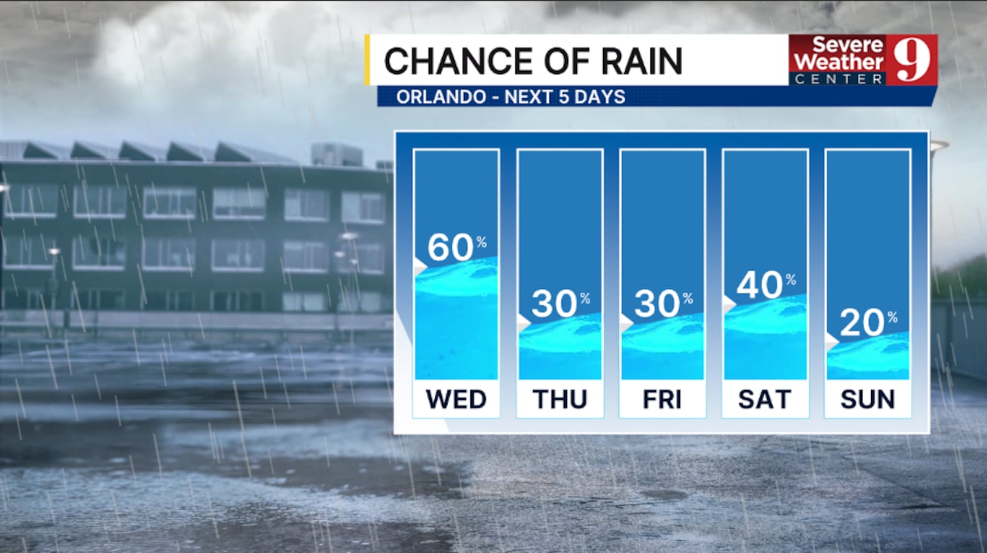
ORLANDO, Fla. — Wednesday featured lower coverage of rain and storms, and even drier air is ahead for the rest of the week.
A frontal boundary is draped over the area, with showers and a few storms remain possible this evening. A few coastal showers will be possible tonight, with morning lows in the low 70s.
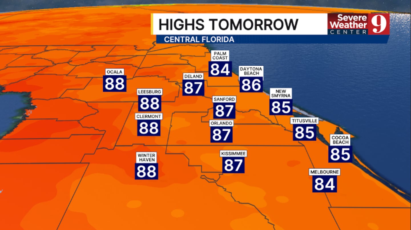
Rain chances lower more for Thursday. The frontal boundary will continue to sag southward, resulting in more scattered shower and storm activity. The best chance for activity will be south of Orlando and along the coast, with highs in the upper 80s.
The dry air continues to filter in for Friday. Just a few isolated showers are expected, with temps in the upper 80s.
This weekend does feature slightly higher rain chances. Onshore winds could drag some scattered showers across the area Saturday with temps in the mid 80s.
Lower coverage of rain and storms looks like on Sunday, with highs in the upper 80s.
Right now, next week looks mostly dry and quiet with highs in the upper 80s.
Click here to download our free news, weather and smart TV apps. And click here to stream Channel 9 Eyewitness News live.

©2025 Cox Media Group


