
ORLANDO, Fla. — It was an active Sunday of rain and storms, and more activity is likely to kick off the work week.
The scattered rain will quickly come to an end this evening, with partly cloudy skies overnight. Morning lows will be in the mid 70s.
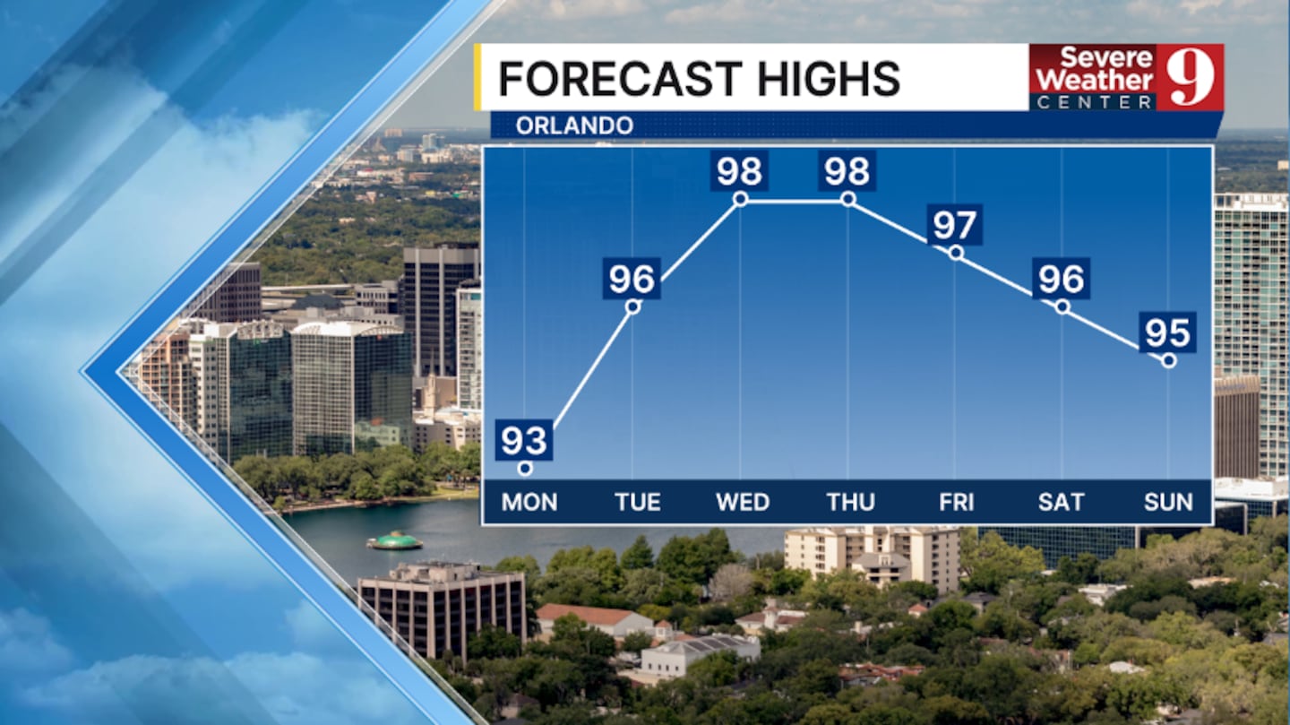
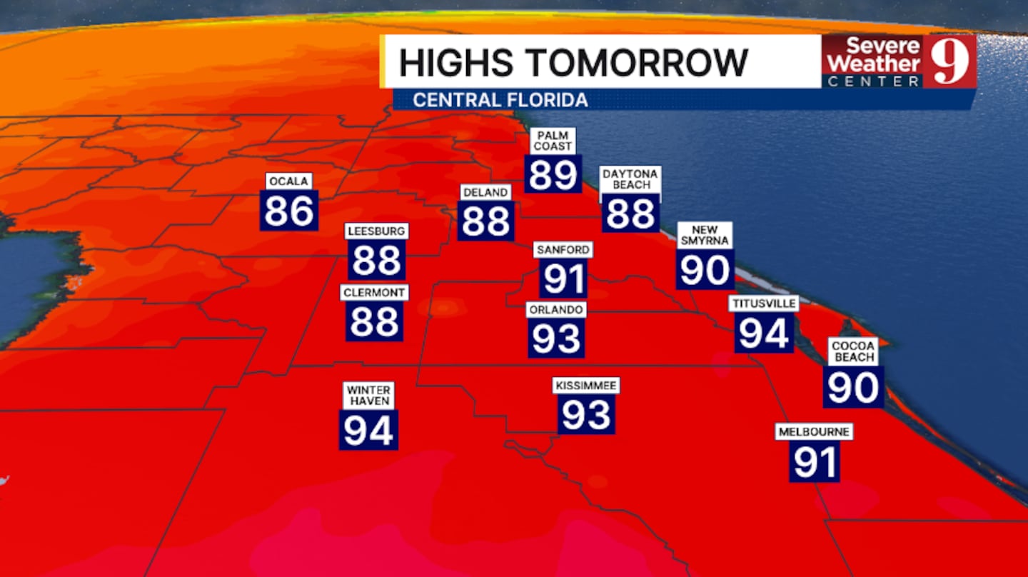
More rain and storms are expected for Monday, but coverage will likely be lower as drier air mixes in. Highs for Monday will be in the low 90s.
We are tracking Weather On the Way for the rest of the work week as Saharan dust once again dries out the atmosphere.
Just widely scattered PM storms are expected Tuesday, with many staying dry. Temps for Tuesday will push into the mid-90s.
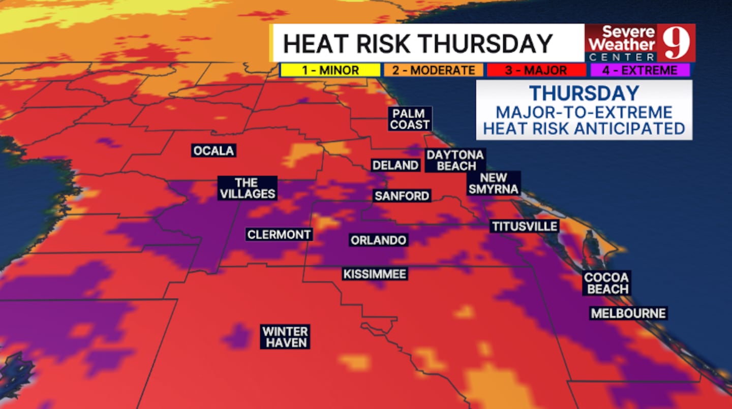
Even drier air pushes in midweek, reducing storm chances to just isolated activity. Highs for Wednesday and Thursday will soar into the upper 90s, with heat indices in the triple digits.
We close out the week with more heat and a slightly better chance for storms. Temps for Friday will again be in the upper 90s, with heat indices likely above 105°.
Click here to download our free news, weather and smart TV apps. And click here to stream Channel 9 Eyewitness News live.

©2026 Cox Media Group


