
ORLANDO, Fla. — Our unsettled weather pattern continued into Saturday, but some changes are on the way to close out the holiday weekend.
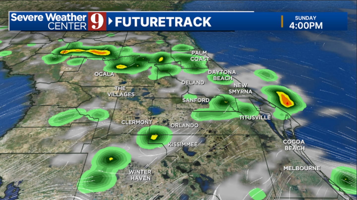
Scattered showers and storms will slowly wind down this evening, and quiet conditions will likely return overnight. Morning temperatures will be in the mid-70s.
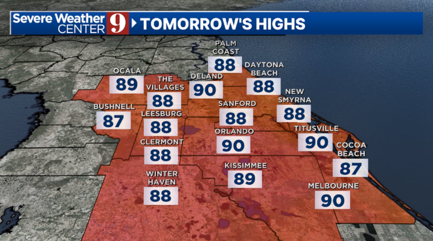
Some drier air from Georgia will begin to push into the area for Sunday. This will reduce coverage of PM rain and storms and bring more sunshine to the area. Highs for Sunday will be in the low 90s.
Even more dry air now looks likely to start next week. Some scattered PM showers and storms are expected across the region, with highs on Monday in the low 90s.
A more typical rainy season weather pattern will likely occur during the middle part of next week. Partly cloudy skies will develop in the morning, with scattered showers and storms in the afternoon and evening. Tuesday and Wednesday’s highs will be in the low 90s.
Some increased moisture now looks possible for late next week. This would increase rain and storm chances across the area, with temps holding in the low 90s
Click here to download our free news, weather and smart TV apps. And click here to stream Channel 9 Eyewitness News live.

©2025 Cox Media Group


