
ORLANDO, Fla. — Saturday has featured typical scattered storms, but eyes now turn to Tropical Depression Nine near Cuba.
This evening, scattered showers will fade, but activity may linger along the coast. Morning lows will be in the mid-70s.
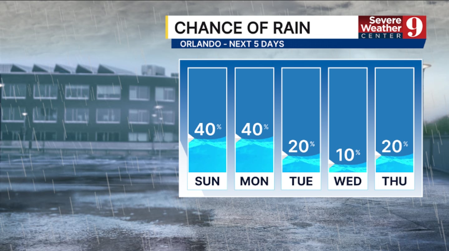
More scattered showers and storms are expected ahead of the tropical system on Sunday. The best chance for activity will be in the PM hours, with highs in the upper 80s.
Conditions will worsen along the coast Sunday evening and Sunday night as TD Nine lifts northward. Some outer bands of rain and wind are possible.
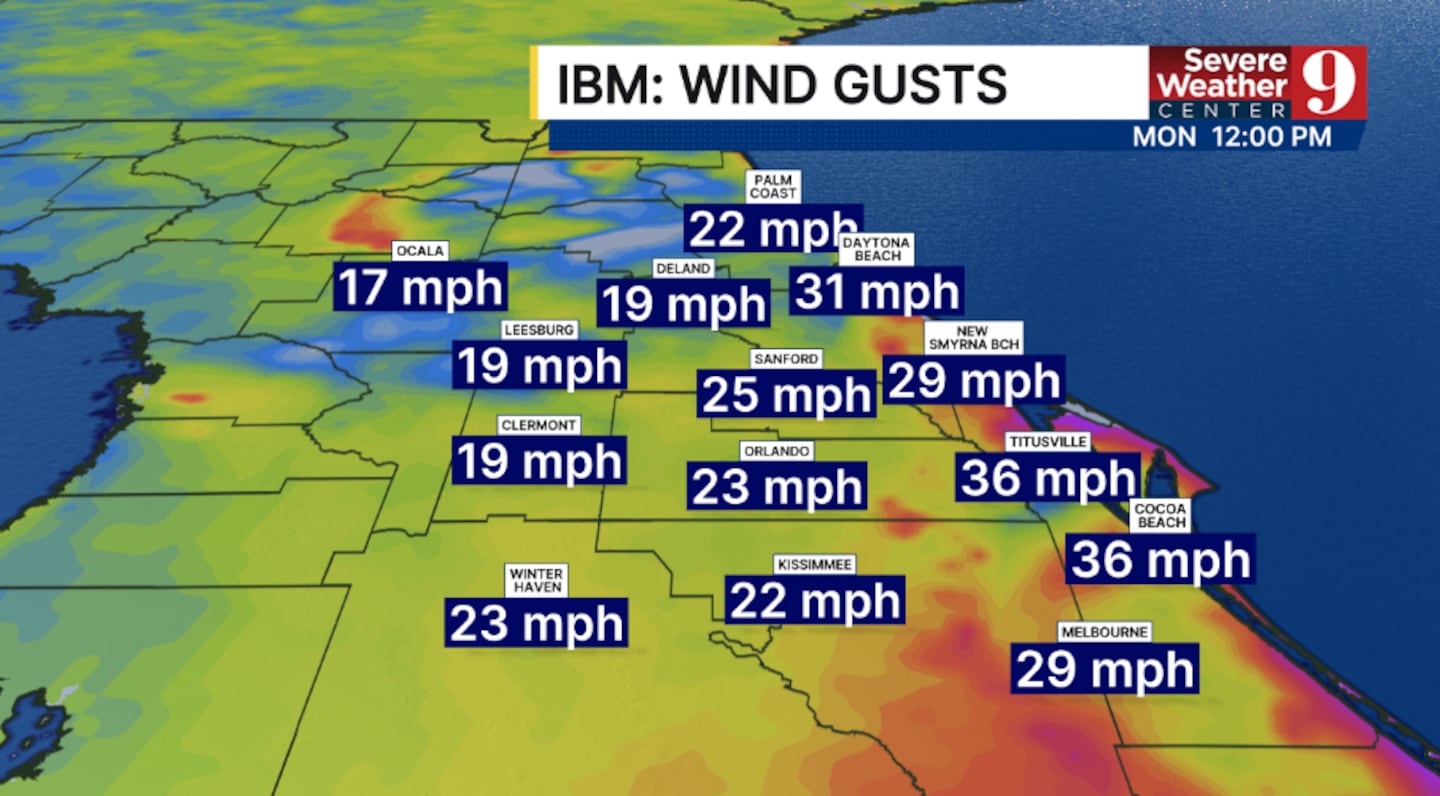
Monday will likely be the closest pass for TD Nine. The worst conditions will be right at the coast, with much of the area experiencing breezy-to-windy conditions. Temps for Monday will be in the mid-80s.
TD Nine lifts northward by the middle of next week, improving conditions at the coast. The system will bring in drier and cooler air, with temperatures in the 80s for much of next week.
Stay with Severe Weather Center 9 for the latest on Tropical Depression Nine.
Click here to download our free news, weather and smart TV apps. And click here to stream Channel 9 Eyewitness News live.

©2025 Cox Media Group


