
ORLANDO, Fla. — It was an active Wednesday across the area, and more unsettled weather is expected on Thursday.
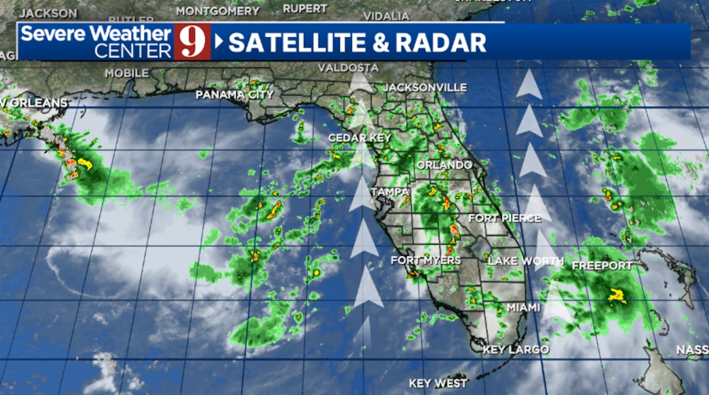
Showers and storms will remain possible this evening, with some continuing overnight as deep tropical moisture moves into the region. Expect morning lows in the mid 70s.
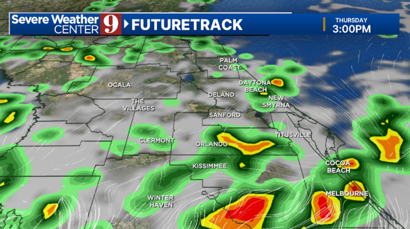
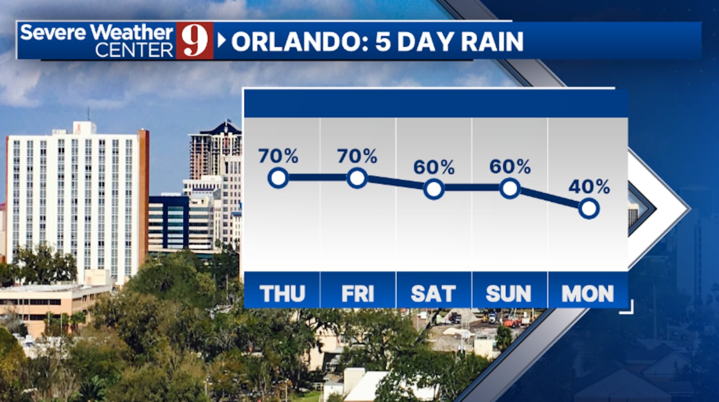
More rain and storms are likely for the busy travel day Thursday. Activity could persist throughout the day, with periods of heavy rain possible. Highs will reach the upper 80s.
The active weather pattern will carry into the July 4th holiday. While a complete washout is not expected, periods of rain and storms are likely. Temperatures for Independence Day will be in the upper 80s.
All eyes will turn to the Gulf and Atlantic this weekend, as a potential tropical system may form near Florida.
Regardless of development, rain and storms are expected Saturday into Sunday, with highs in the mid to upper 80s.
Slightly drier air will begin to move in next week, somewhat reducing the coverage of rain and storms. More sunshine is also expected, with highs in the low 90s on Monday and Tuesday.
Click here to download our free news, weather and smart TV apps. And click here to stream Channel 9 Eyewitness News live.

©2025 Cox Media Group


