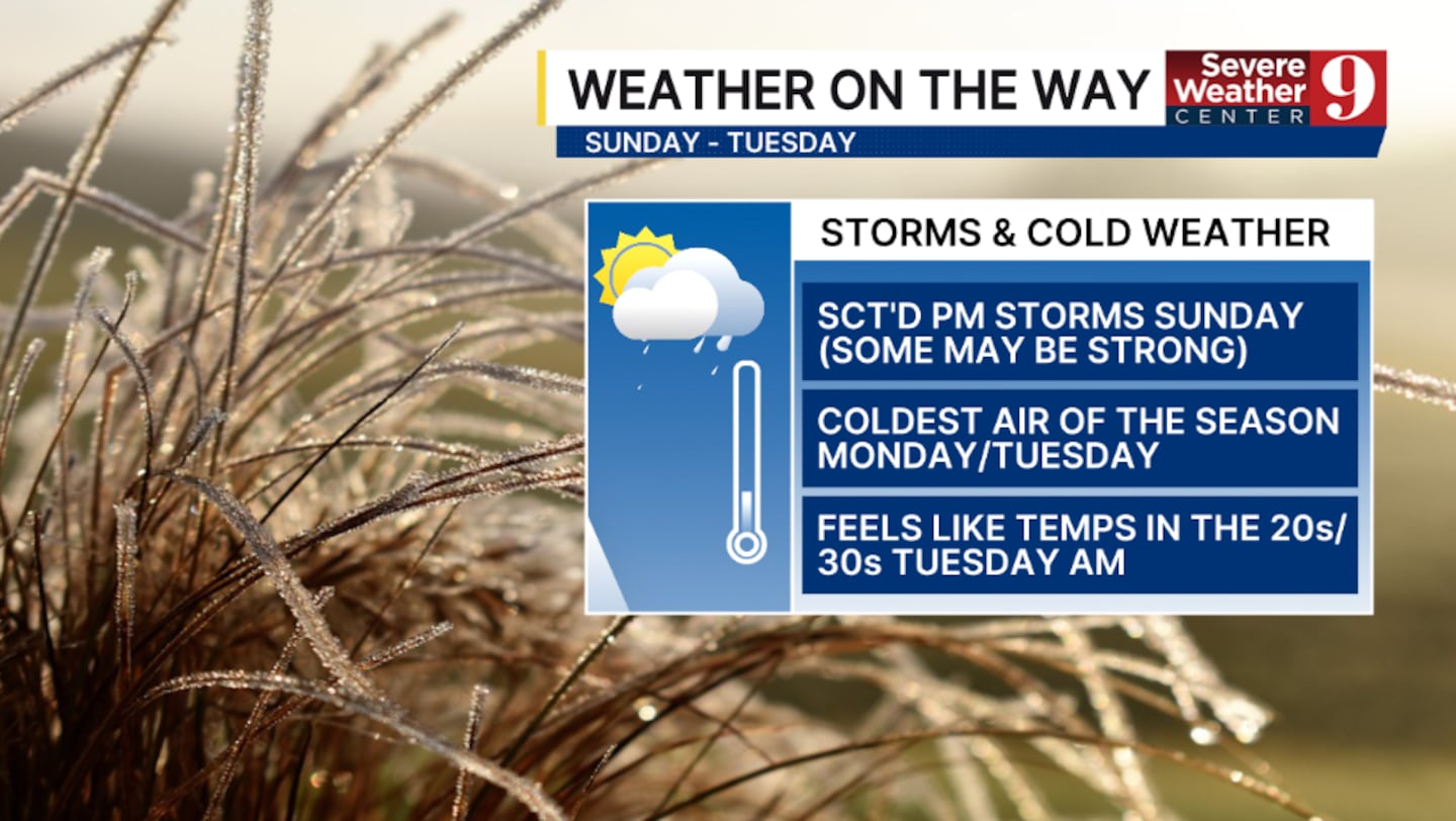
ORLANDO, Fla. — We have Weather On the Way from Sunday to Tuesday, as strong storms and the coldest air of the season impact Central Florida.
A strong cold front is expected to move into the region on Sunday. Ahead of it, scattered showers and storms are looking increasingly likely to develop. An isolated strong to severe storm will be possible in the late afternoon and evening hours.
The greatest threats with these storms will be gusty winds and small hail, with highs Sunday in the mid-80s.
Behind the front, the coldest air of the season plunges into the region. Highs on Monday are expected to be in the mid-60s, accompanied by strong northerly winds.
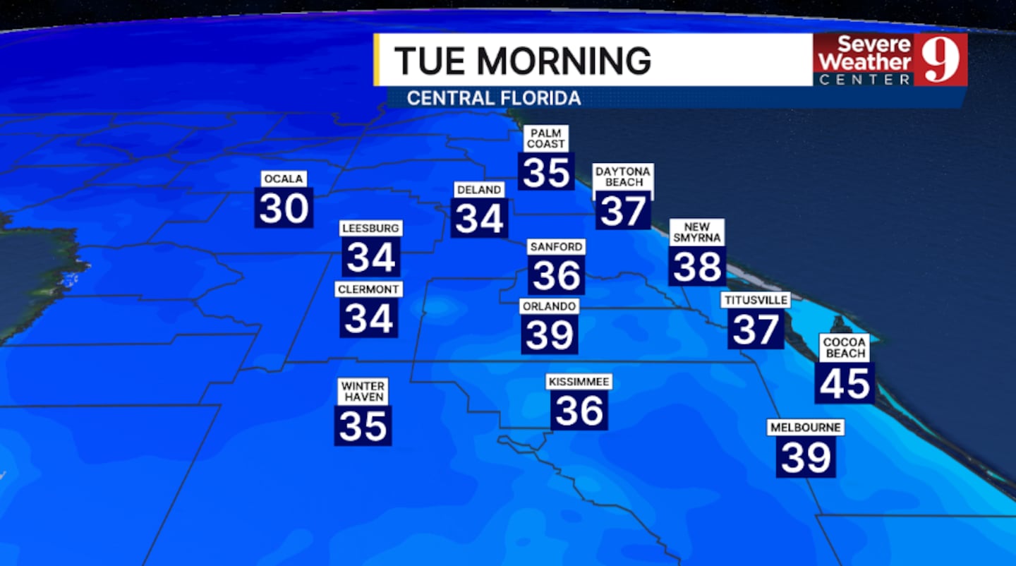
Temps will really tumble Monday night, when morning lows will be the coldest since late February. Morning lows will be in the 30s and 40s, with feels-like temps in the 20s and 30s by daybreak Tuesday.
Cold Weather Advisories are increasingly likely for Tuesday morning.
Tuesday will be the coldest day of the stretch, with highs now struggling to reach the upper 50s.
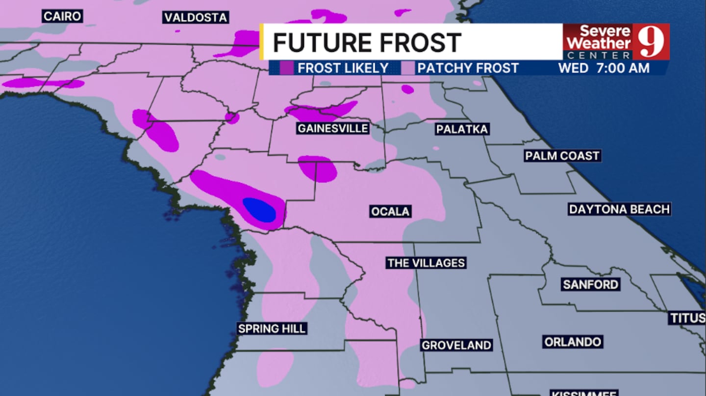
Tuesday night could be the first frost of the season for some in the area. Winds will lighten, which could allow frost to form in areas west and northwest of Orlando. Morning lows will be in the mid-40s.
Stay with Severe Weather Center 9 for the latest on the storm threat Sunday and the chilly blast for next week.
Click here to download our free news, weather and smart TV apps. And click here to stream Channel 9 Eyewitness News live.

©2025 Cox Media Group