
ORLANDO, Fla. — The tropics are turning active, with now three areas to monitor – and one likely becoming a tropical storm soon.
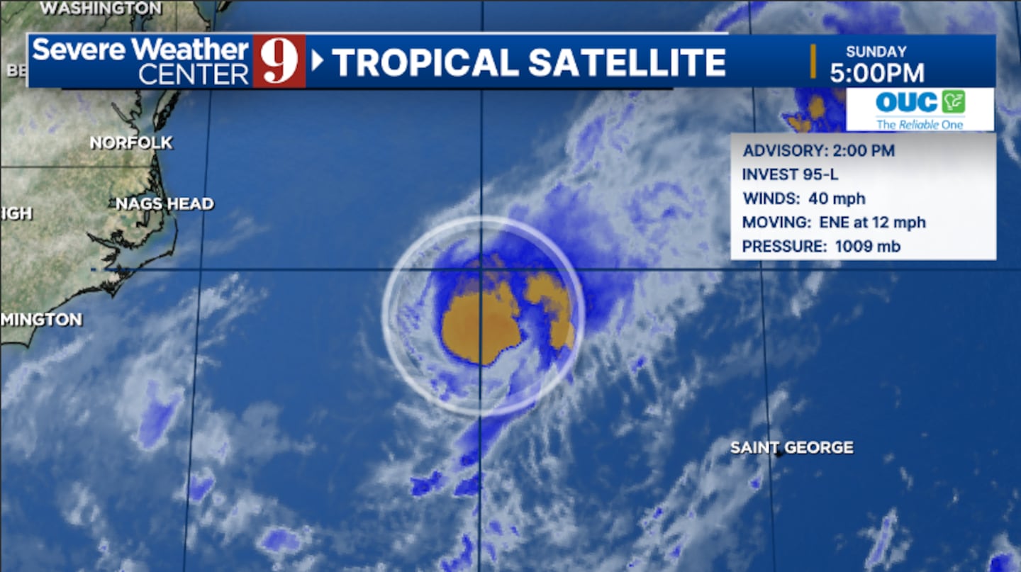
The first area of interest, known as Invest 95L, is a low-pressure system off the Carolina coast. This has steadily been organized in the past 24 hours and will likely be organized further.
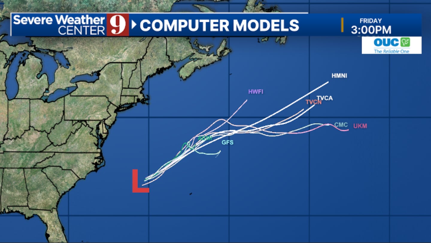
The National Hurricane Center is giving this area a High Development Chance, and this will likely become a tropical storm by Monday.
95L will likely move quickly away from the US and will likely head out to sea by midweek.
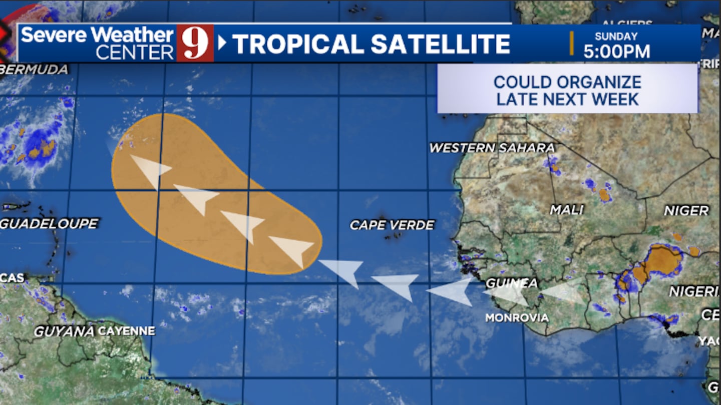
The second area is a tropical wave that will roll off the coast of Africa by late Monday.
This wave will slowly move into the open waters of the Atlantic, where it could be organized late in the week.
This has a Medium Development Chance and could become a tropical depression.
The third area is a second region off the Carolina and Georgia coast.
A stationary front will cover the region this week, and a new area of low pressure could form late in the week.
This has a Low Development Chance.
At this time, none of the areas are threatening Florida, but will continue to be monitored.
Stay with Severe Weather Center 9 for the latest on the tropics all season long.
Click here to download our free news, weather and smart TV apps. And click here to stream Channel 9 Eyewitness News live.

©2025 Cox Media Group


