
ORLANDO, Fla. — A Weather Alert Day remains in effect for Sunday as strong to severe storms will likely impact much of the region.
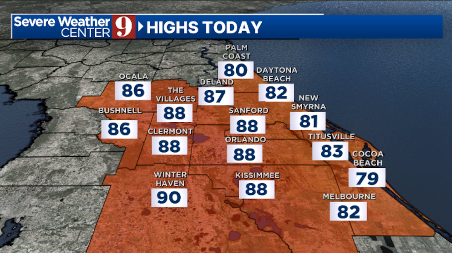
Saturday will feature dry conditions and very warm temperatures. Winds will increase as the day progresses, and highs will soar into the upper 80s.
Variable clouds overnight are expected to have more warmth. Morning lows will only be in the low 70s.
Sunday morning will feature increasing clouds, with strong storms moving into the area during the afternoon hours.
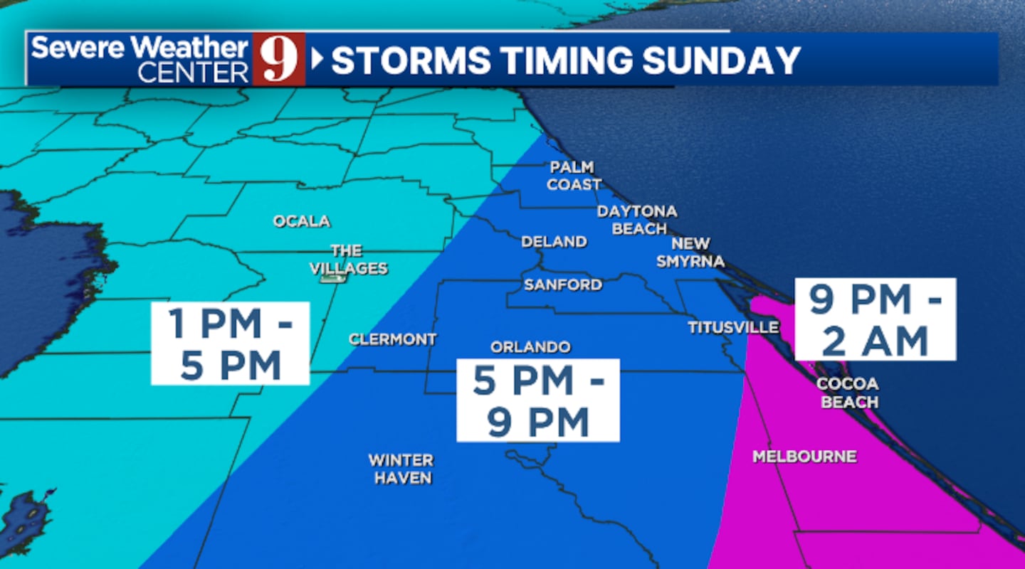
The storms will continue to push through the region during the evening and overnight.
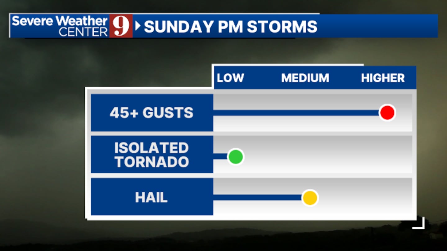
Some storms may be strong to severe, with gusty winds, hail, and isolated tornadoes the biggest threats. It will also be windy, with highs soaring to near 90 degrees.
The storms will exit by daybreak Monday, leading to a very pleasant St. Patrick’s Day. There will be plenty of sunshine, with cooler highs in the low 70s.
The rest of next week looks fairly tranquil, with highs in the 70s and 80s and a minimal threat of rain on Thursday.
Stay with Severe Weather Center 9 for Sunday’s very latest severe storm threat.
Click here to download our free news, weather and smart TV apps. And click here to stream Channel 9 Eyewitness News live.

©2025 Cox Media Group


