ORLANDO, Fla. — Severe Weather Center 9 is tracking three active tropical systems in the Atlantic.
11:11 a.m. update:
Tropical Storm Humberto has gained strength Thursday morning, while a second system is likely to develop by the weekend.
The second area, called Invest 94L, is slowly organizing near the Dominican Republic.
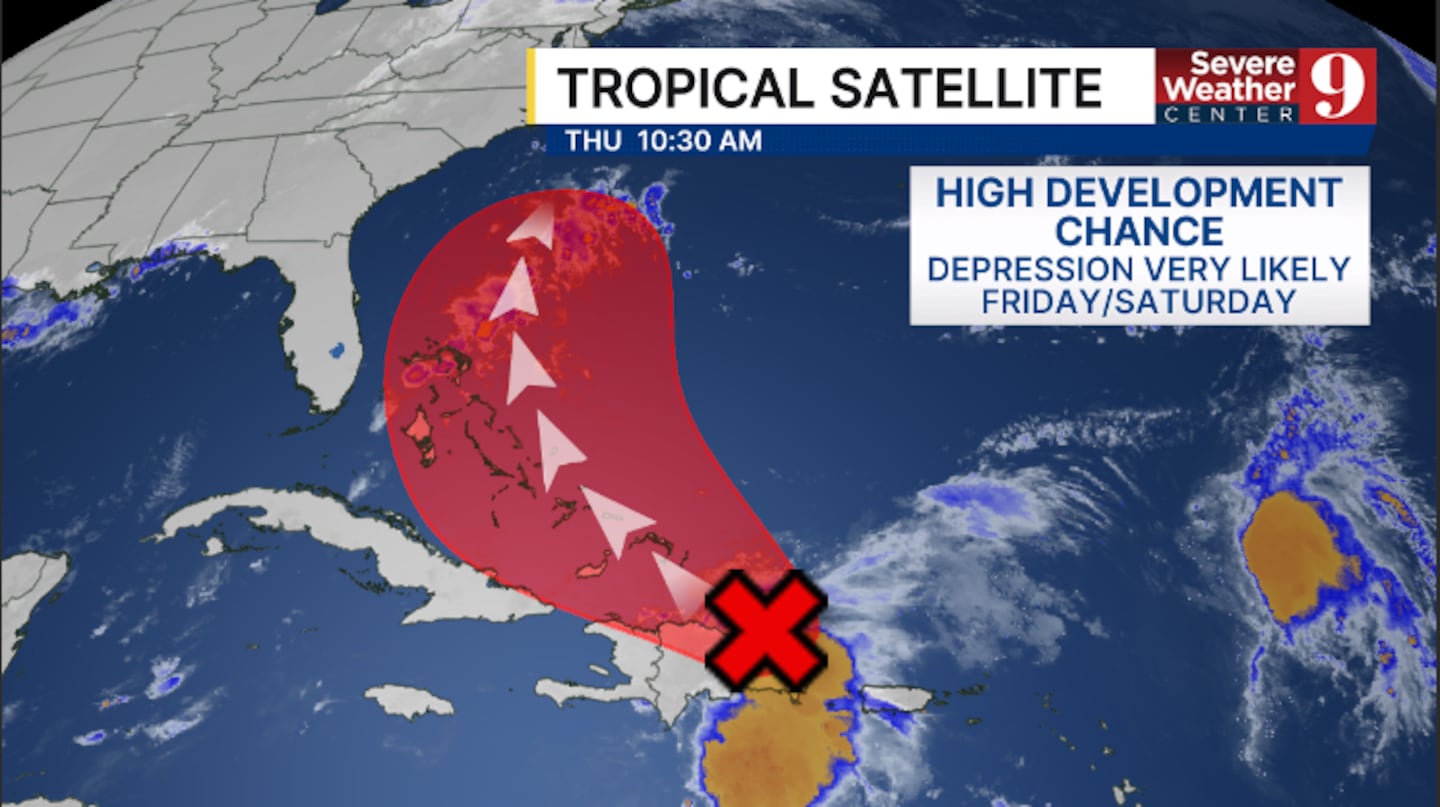
This system has a High Development Chance and will very likely be a tropical depression by this weekend.
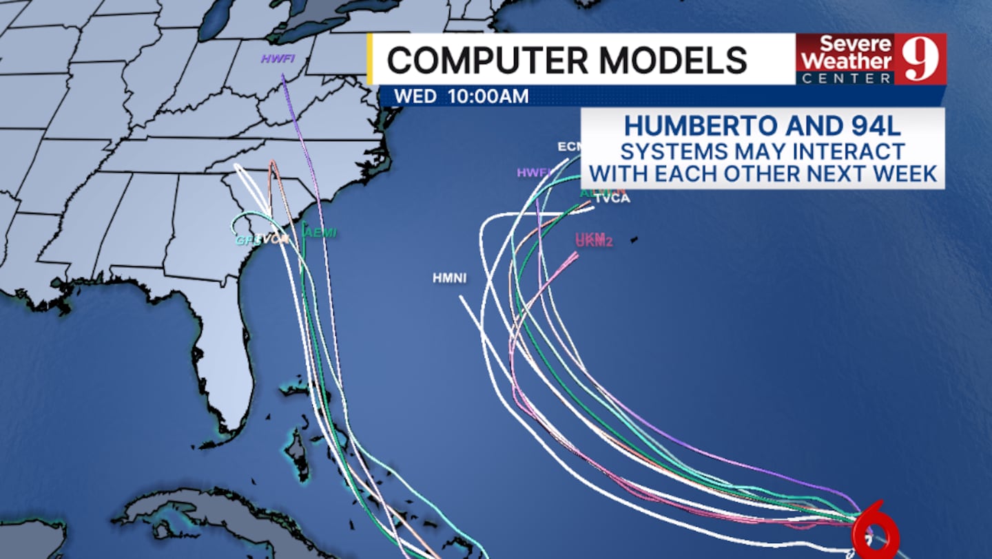
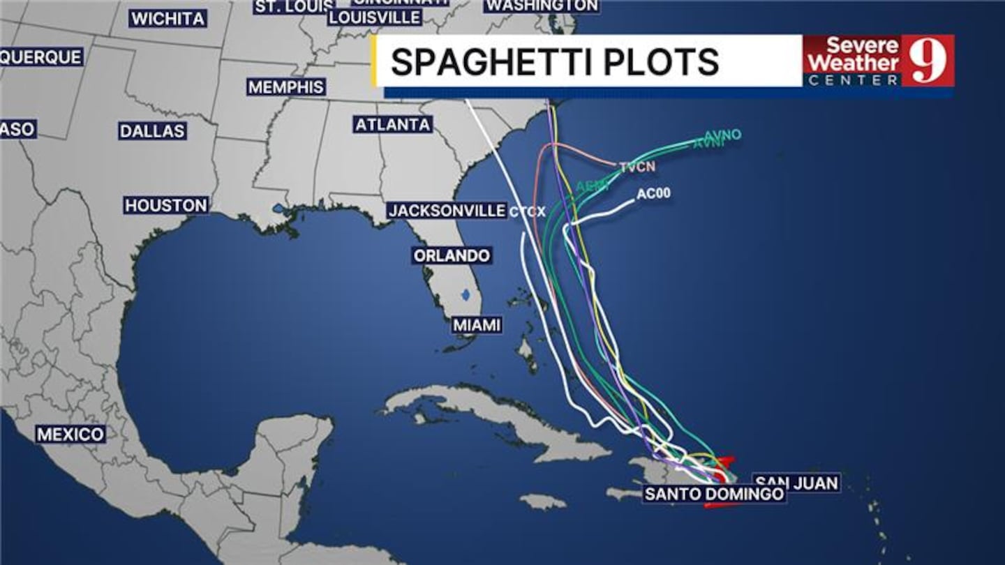
Computer models are indicating Humberto and 94L could interact with each other, but both may stay separate systems.
Right now, 94L will likely move across the Bahamas next week, and could create marine and beach impacts along the east coast of Florida.
94L is a system that will need to be monitored should it drift further west than currently forecast.
Humberto remains east of 94L in the open Atlantic.
The 11 am advisory on Humberto from the National Hurricane Center has winds of 50 mph.
Humberto is forecast to strengthen to a hurricane on Friday and become a major hurricane over the weekend.
The storm is moving to the west-northwest and is expected to continue moving west-northwestward the next several days.
Humberto is not a direct threat to land over the next 5 days.
Gabrielle moving toward Azores
Elsewhere in the Atlantic, Gabrielle remains a hurricane and is closing in on the Azores.
The 11 a.m. advisory from the National Hurricane Center had winds of 75 mph, making Gabrielle a Category 1 storm.
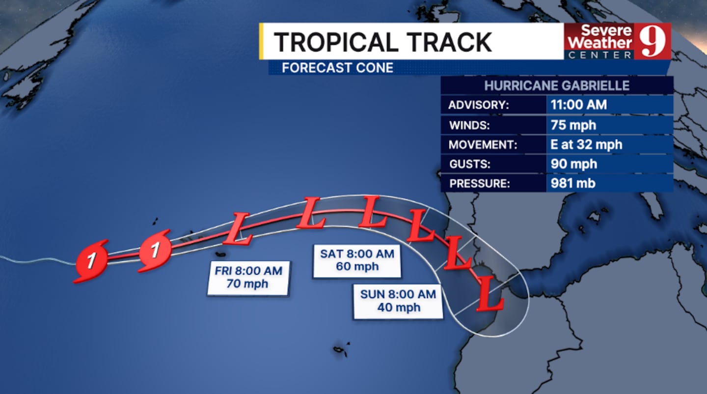
Gabrielle will move across the Azores Thursday night into Friday, where Hurricane Warnings are in effect.
Stay with Severe Weather Center 9 for the latest on the tropics.
Original report:
Tropical Storm Humberto is expected to strengthen into a hurricane this weekend, but it is not anticipated to impact Central Florida as it remains over the Atlantic.
Meanwhile, Invest 94L, currently over the Dominican Republic, is bringing wet and gusty conditions to Puerto Rico, the Dominican Republic, and Haiti.
The system is likely to develop near the Turks and Caicos by Saturday, potentially impacting parts of the Bahamas with heavy rain and gusty winds.
As Humberto strengthens, it could influence the path of Invest 94L, which might develop into Tropical Storm Imelda by the weekend.
Forecast models for Invest 94L remain uncertain. Some suggest that Humberto might absorb the storm, while others predict it could head towards the South Carolina coast.
This uncertainty means that the situation requires close monitoring over the coming days.
Residents along the east coast should prepare for potential advisories as conditions could worsen, while keeping an eye on the evolving situation with Invest 94L and Humberto.
Click here to download our free news, weather and smart TV apps. And click here to stream Channel 9 Eyewitness News live.

©2025 Cox Media Group


