
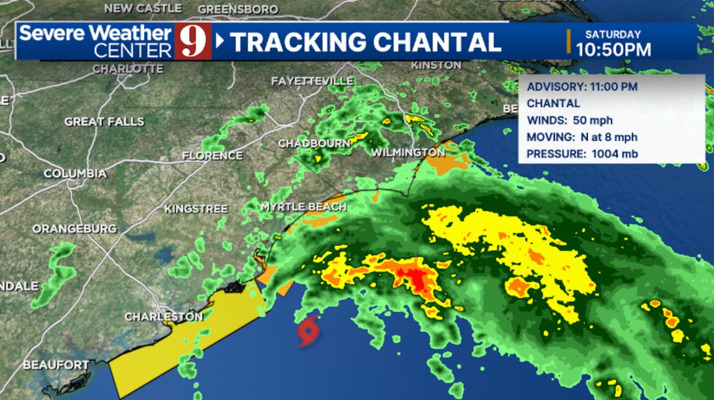
ORLANDO, Fla. — Tropical Storm Chantal is slightly stronger Saturday evening, as it nears landfall in coastal South Carolina.
The 11 p.m. advisory from the National Hurricane Center has increased winds to 50 mph.
Tropical Storm Warnings continue for part of the South Carolina coastline, and landfall will occur in the early morning hours Sunday, south of Myrtle Beach.
Chantal is expected to remain a tropical storm as it nears South Carolina tonight.
The storm formed Saturday morning as Tropical Depression Three was upgraded in the Atlantic.
The biggest issues with Chantal will be gusty winds and heavy rainfall.
Tropical storm force winds will be possible along the South Carolina coast tonight. Rainfall of 2-4 inches is expected, with local amounts of 6 inches.
The system will move north, away from Florida. The complex will actually help drag dry air into the area for Sunday and the early part of next week.
Chantal is the third named storm of the Atlantic hurricane season, and the first to directly impact the United States.
Stay with Severe Weather Center 9 for the latest on the tropics.,
Click here to download our free news, weather and smart TV apps. And click here to stream Channel 9 Eyewitness News live.

©2025 Cox Media Group


