ORLANDO, Fla. — A Weather Alert Day has been issued for Friday due to significant coastal impacts.
Flooding rains, strong winds and significant coastal flooding are likely into Friday night.
A cold front and a developing Nor’easter in the Atlantic are combining to produce heavy rain, gusty winds and coastal flooding.
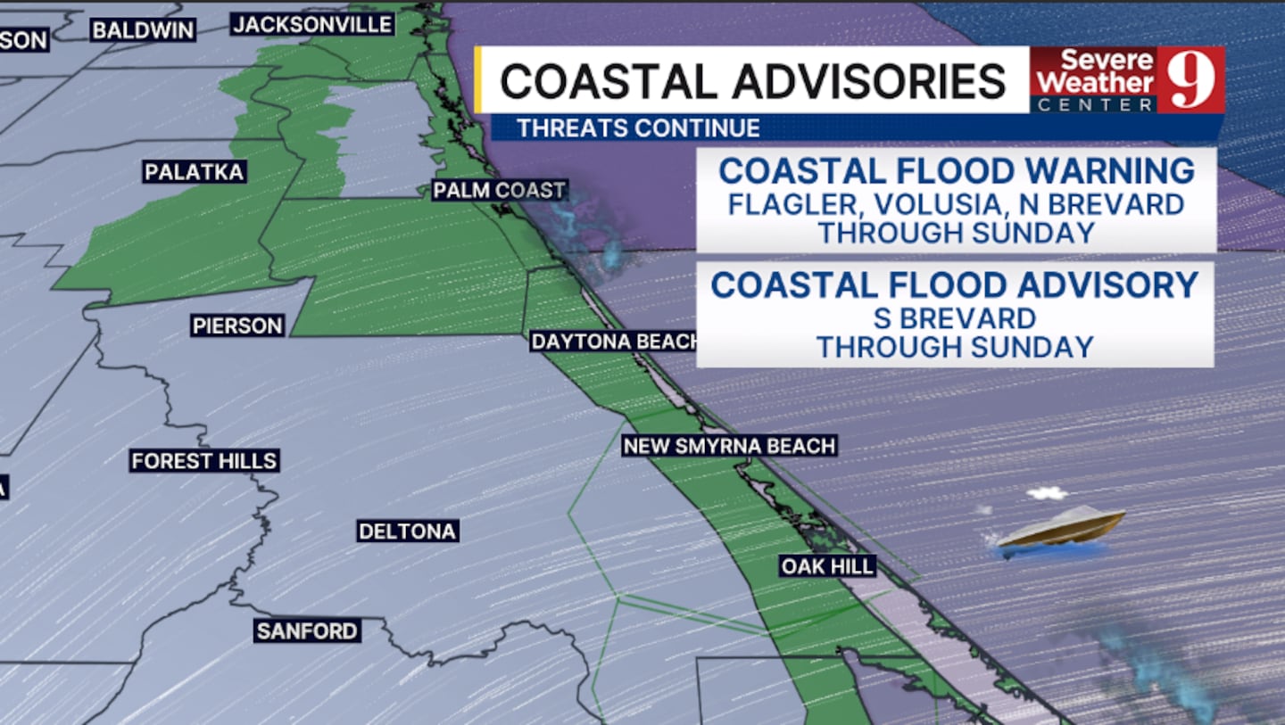
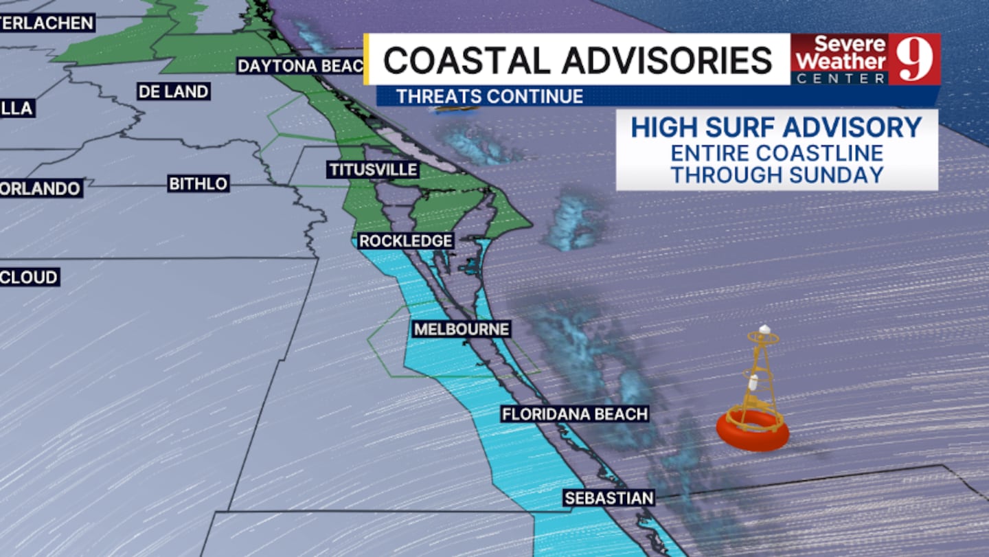
A flood watch continues for Volusia and Brevard counties has been extended until Saturday morning. This includes the cities of Playalinda Beach, Debary, Canaveral Groves, Deltona, Palm Bay west of I 95, Port Saint John, Deland, Cocoa, Cocoa Beach, Mims, Melbourne Beach, Merritt Island Wildlife Refuge, Rockledge, Ormond Beach, Titusville, New Smyrna Beach, Viera West, Melbourne, Satellite Beach and Daytona Beach.
Flash flooding has been reported in the New Smyrna Beach and Edgewater areas.
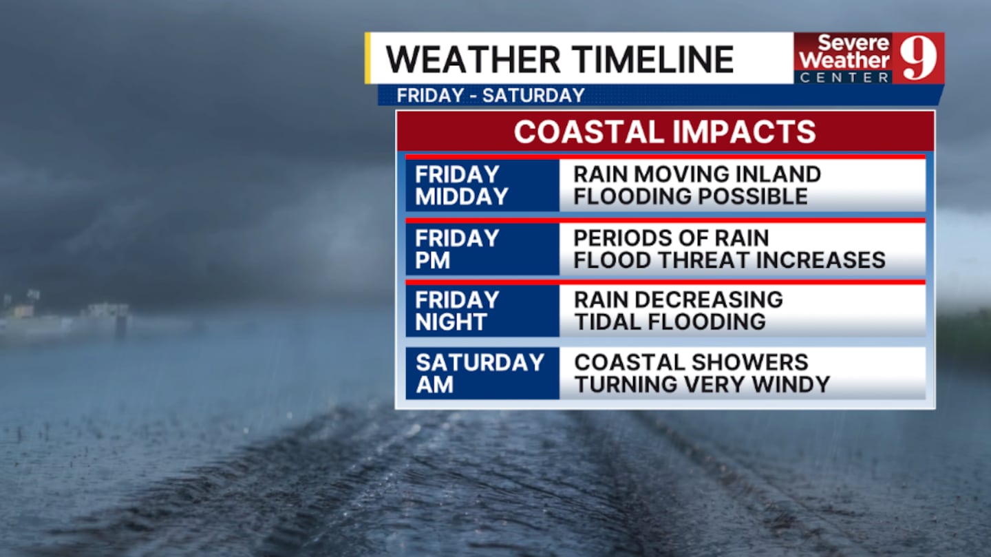
TIMELINE
Bands of rain from the Atlantic will continue to develop and push inland during the mid-day hours. These bands have already produced flooding in parts of the area, and additional flooding is possible.
It will remain breezy to windy, with the worst winds at the coast.
Later Friday afternoon, periods of rain and storms are anticipated. These will be the highest chance for flooding in the area.
Winds will remain elevated at the coast, with gusts over 30 mph possible.
This evening, the rain bands will begin to decrease, but scattered showers are still anticipated.
Another high tide cycle arrives late evening, resulting in another round of minor to moderate tidal flooding.
By Saturday morning, the shower activity will likely be confined to coastal areas, but the developing Nor’Easter could create wind gusts over 35 mph at the coast.
UPDATES
Stay with Severe Weather Center 9 for the latest on the Weather Alert Day throughout Friday.
Watch on air coverage on Channel 9 at noon, 4, 5, 6, 10 and 11.
Download our news and weather apps for continuing coverage.
Click here to download our free news, weather and smart TV apps. And click here to stream Channel 9 Eyewitness News live.

©2025 Cox Media Group