
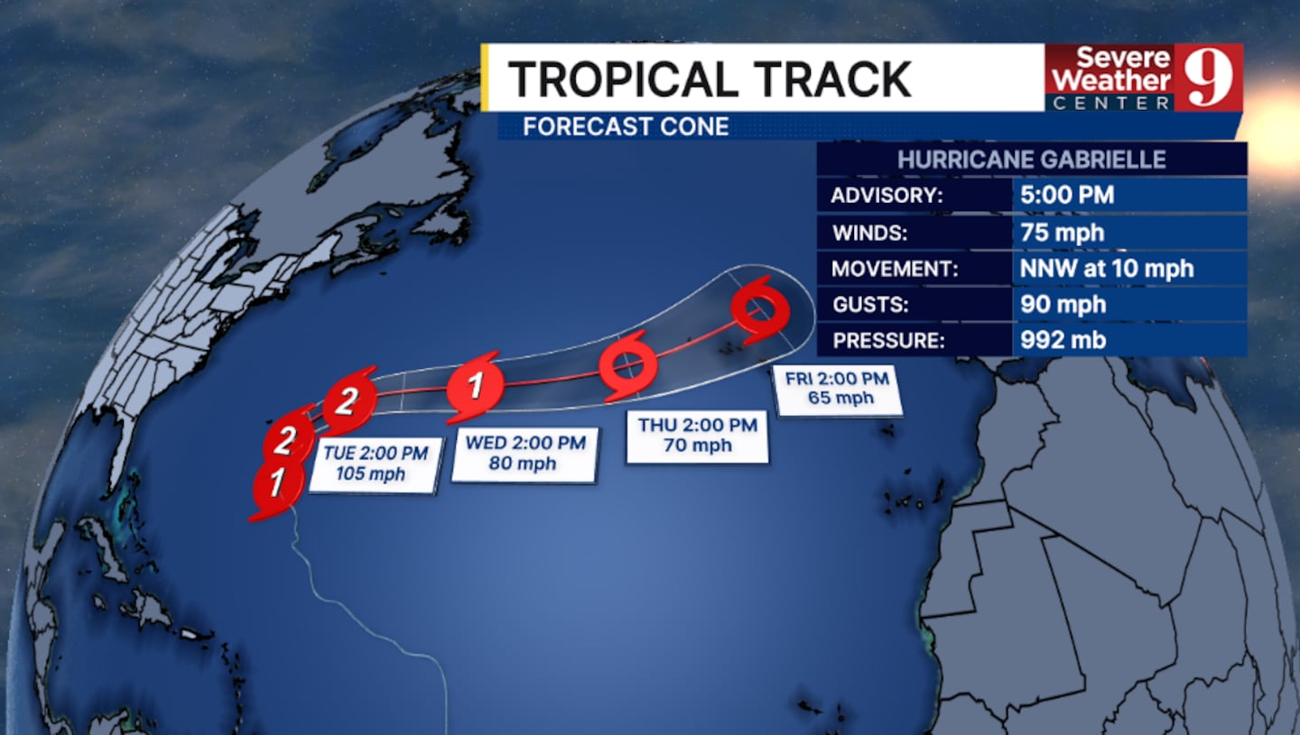
ORLANDO, Fla. — Gabrielle strengthened into a hurricane in the open Atlantic on Sunday evening.
The 5 p.m. advisory from the National Hurricane Center said Gabrielle had winds of 75 mph, making it a Category 1 storm.
It is only the second hurricane in the Atlantic this season. Hurricane Erin was a Category 5 hurricane in August.
Steady to rapid intensification is now forecast, and it is possible that Gabrielle becomes a major hurricane.
The storm is expected to turn northward on Monday and even push northeastward by midweek.
Gabrielle will stay thousands of miles away from Florida and the United States.
Interests in Bermuda should continue to monitor Gabrielle in the coming days, as wind and rain impacts remain possible.
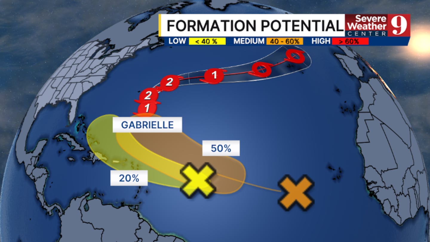
Elsewhere, there are now two tropical waves to monitor.
The first is a tropical wave in the central open Atlantic. This system could organize more and become a tropical depression later this week.
This is now a Medium Development Chance.
A second tropical wave is also being monitored closer to the Lesser Antilles.
This could organize some over the next couple of days and it has a Low Development Chance.
Stay with Severe Weather Center 9 for the latest on the tropics.
Click here to download our free news, weather and smart TV apps. And click here to stream Channel 9 Eyewitness News live.

©2025 Cox Media Group


