ORLANDO, Fla. — Erin is now a post-tropical cyclone as it moves further away from the United States, so we now turn our attention to two other areas of possible development.
The first one will become a tropical depression by the end of today. It is a few hundred miles from the Bahamas and is already moving north.
It will likely become the next tropical storm at some point on Sunday and will not impact anyone directly besides the island of Bermuda.
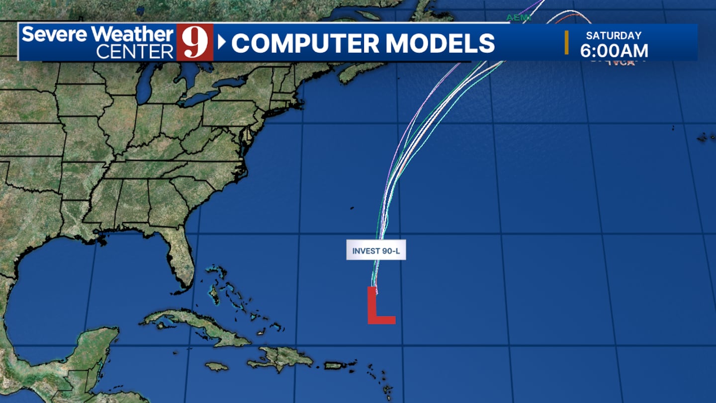
If it does form into a hurricane it will become a category 1 briefly before dying back down to a tropical storm.
The second area of interest is a group of disorganized showers and thunderstorms moving towards the Leeward Islands. The chance of development has dropped since yesterday and conditions will become increasingly unfavorable as it approaches the Caribbean.
Even if this area does form its projected to move straight into central America as opposed to making a turn up towards the Gulf or Florida.
Click here to download our free news, weather and smart TV apps. And click here to stream Channel 9 Eyewitness News live.

©2025 Cox Media Group