Active Warnings
ORLANDO, Fla. — A Severe T-Storm Warning has been issued for northeastern Marion County until 6:15 PM.
This includes Salt Springs.
Movement is to the east at 10 mph.
Greatest threats are winds over 50 mph, intense lightning and large hail.
Expired Warnings
A Severe T-Storm Warning has been issued for southern Osceola County until 5:15 PM.
Movement is nearly stationary.
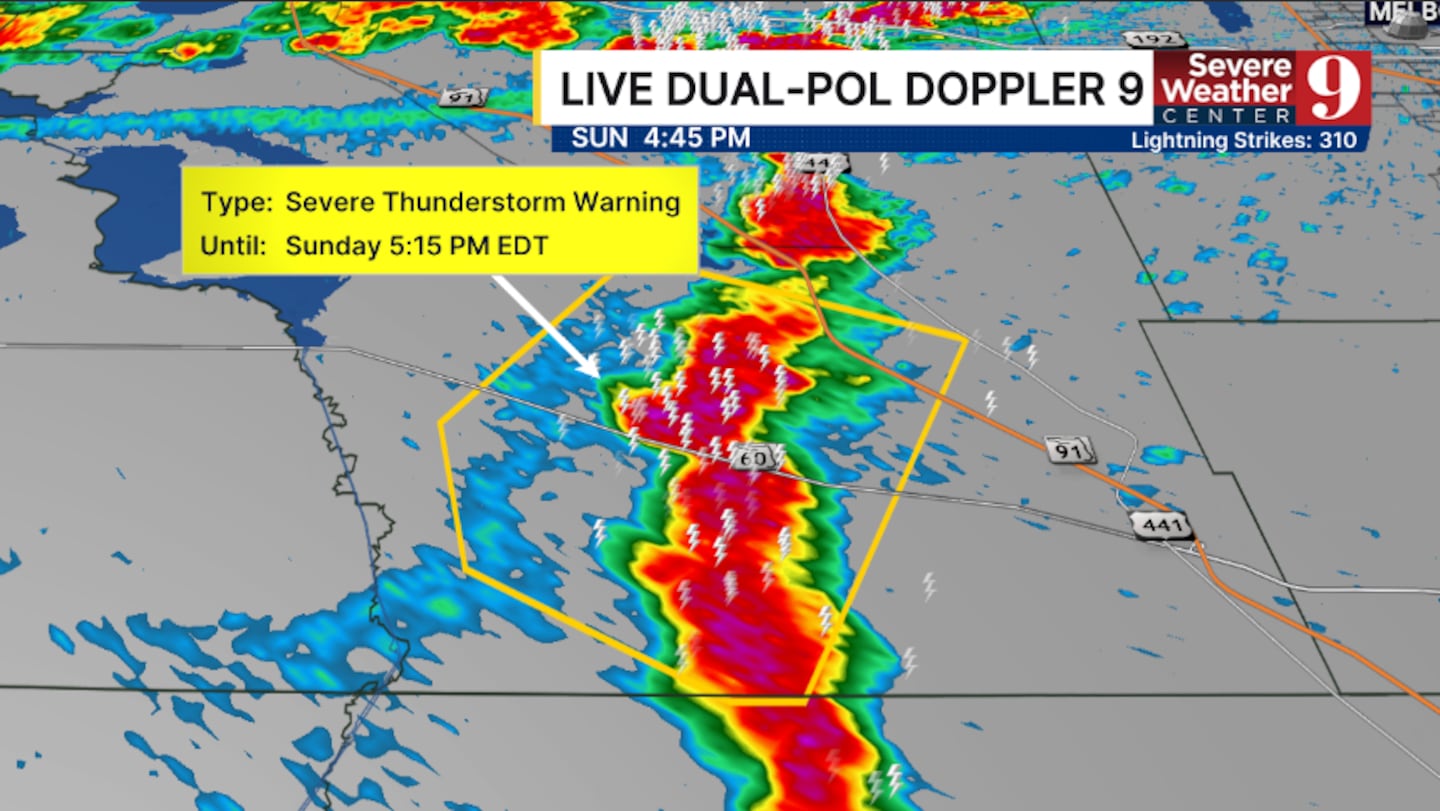
Greatest threats are winds over 50 mph, intense lightning and large hail.
A Severe T-Storm Warning has been issued for central Brevard, southeastern Orange, and northeastern Osceola counties until 4:45 PM.
This includes Melbourne, Rockledge, and Viera.
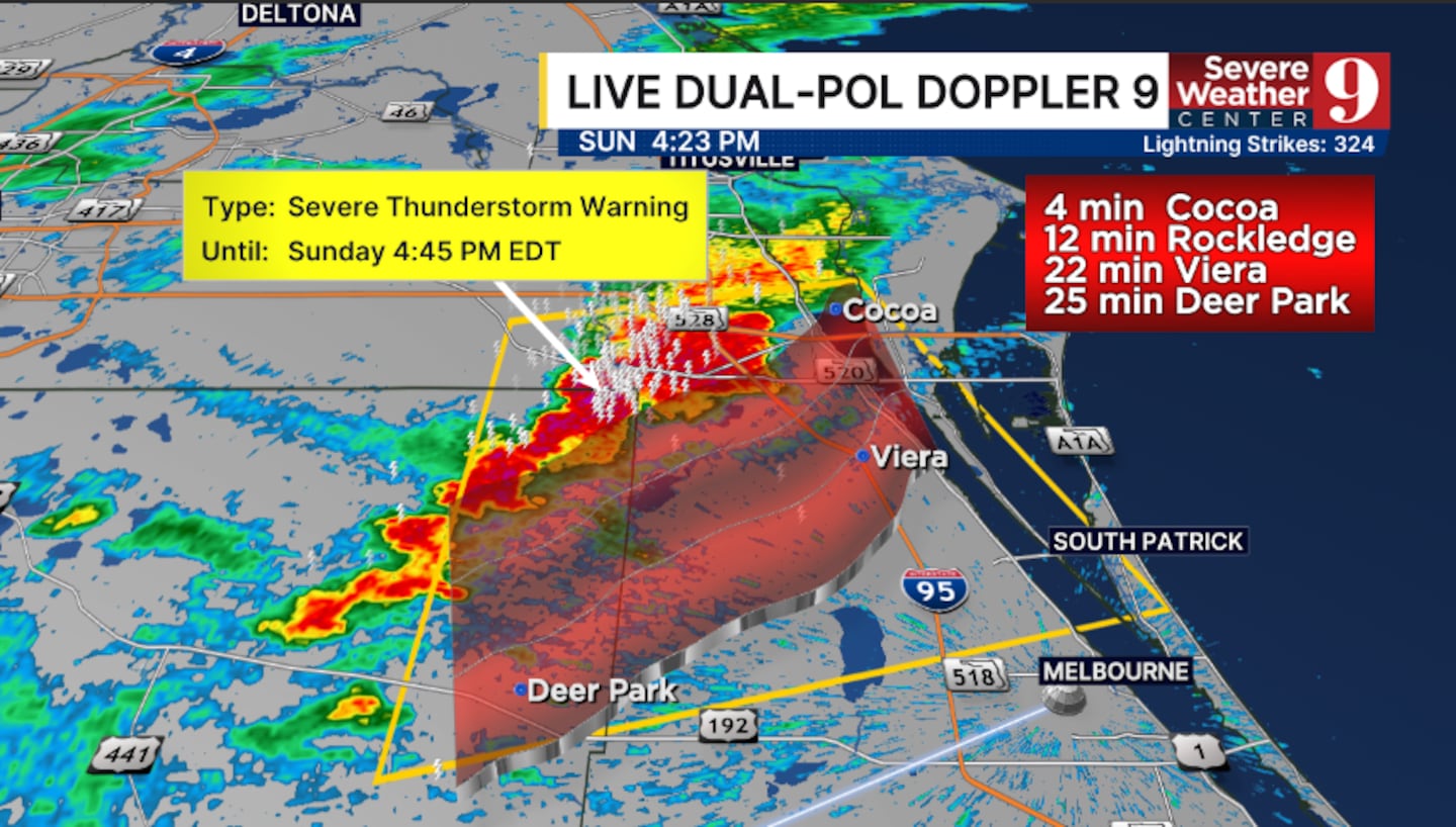
Movement is southeast at 25 mph.
Greatest threats are winds over 50 mph, intense lightning and small hail.
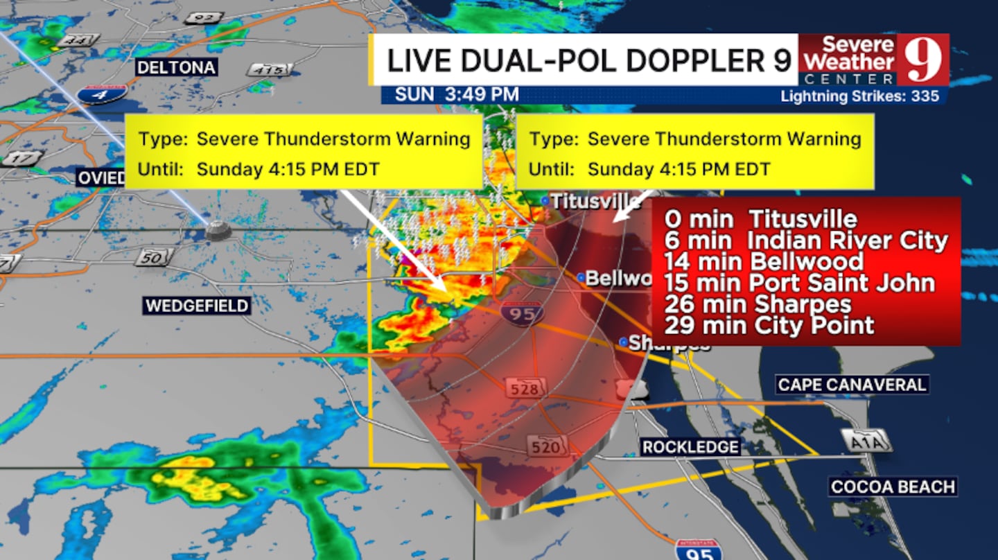
A Severe T’Storm Warning has been issued for northwestern Brevard and eastern Orange counties until 4:15 PM.
This includes Titusville and Rockledge.
Movement is southeast at 20 mph.
Greatest threats are winds over 50 mph, intense lightning and small hail.
Additional strong to severe storms are possible across much of Central Florida through the mid-evening hours.
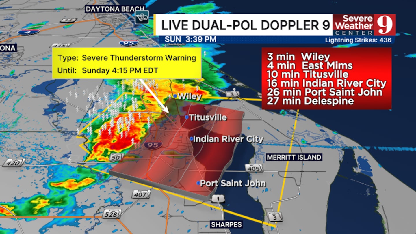
A Severe T’Storm Warning has been issued for northwestern Brevard County until 4:15 PM.
This includes Titusville and Port St. John.
Movement is east at 15 mph.
Greatest threats are winds over 50 mph, intense lightning and small hail.
Additional strong to severe storms remain possible across much of Central Florida through the mid-evening hours.
Click here to download our free news, weather and smart TV apps. And click here to stream Channel 9 Eyewitness News live.

©2026 Cox Media Group