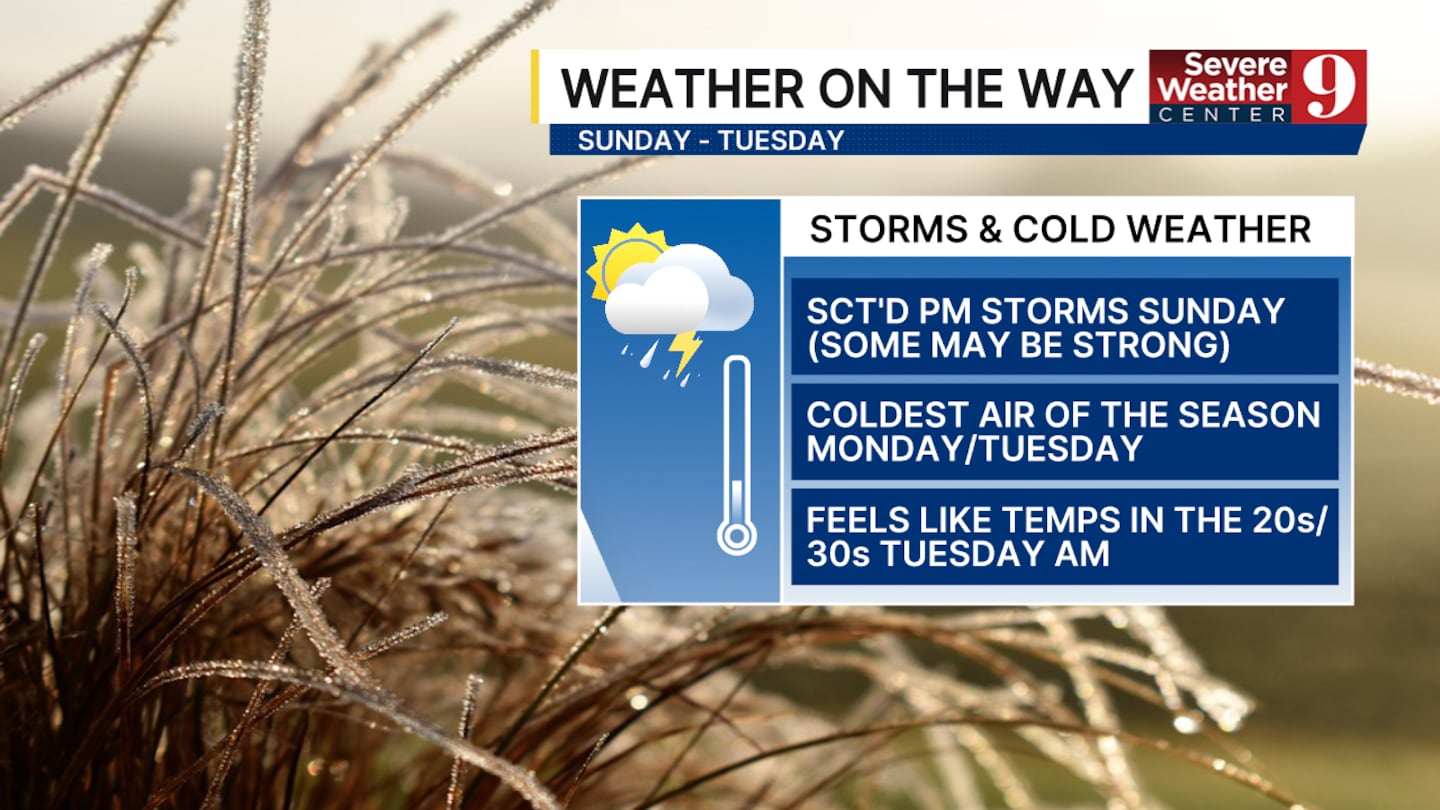
CENTRAL FLORIDA — We have weather on the way today through Tuesday. We are tracking chances of severe weather this afternoon, breezy conditions on Monday, and with the coldest temperatures we have seen since February, which will arrive Tuesday morning.
Our severe weather chances won’t intensify until the middle of this afternoon. Our main threats are heavy rain, wind gusts of 55 mph, and frequent lightning. Some isolated hail in our northern counties cannot be ruled out.

Areas north and east of Orlando have the best chance to see these strong to severe storms.
The severe weather chance will die down once the first front passes us by the middle of the evening.
Central Florida may see strong wind gusts tomorrow. Gusts as high as 25 to 30 mph throughout the entire day. These winds are expected to persist into the overnight hours.

We will also experience a significant cooldown during that time. Overnight lows around central Florida will be the coldest we have seen since February 21st. Orlando has a chance to fall into the upper 30s, while some portions of Marion County could drop below freezing.
Frost is also possible mainly northwest of Orlando on both Tuesday and Wednesday morning.
Dry air will help us warm up quickly. We expect our lows to return to the 50s by Thursday.
Click here to download our free news, weather and smart TV apps. And click here to stream Channel 9 Eyewitness News live.

©2025 Cox Media Group


