ORLANDO, Fla. — We are tracking a potential tropical low in the northern Gulf once again this week.
As of now there is a 20% chance of development. The good news for central Florida is that if this low forms it will take a much different path from what Chantal took last week.
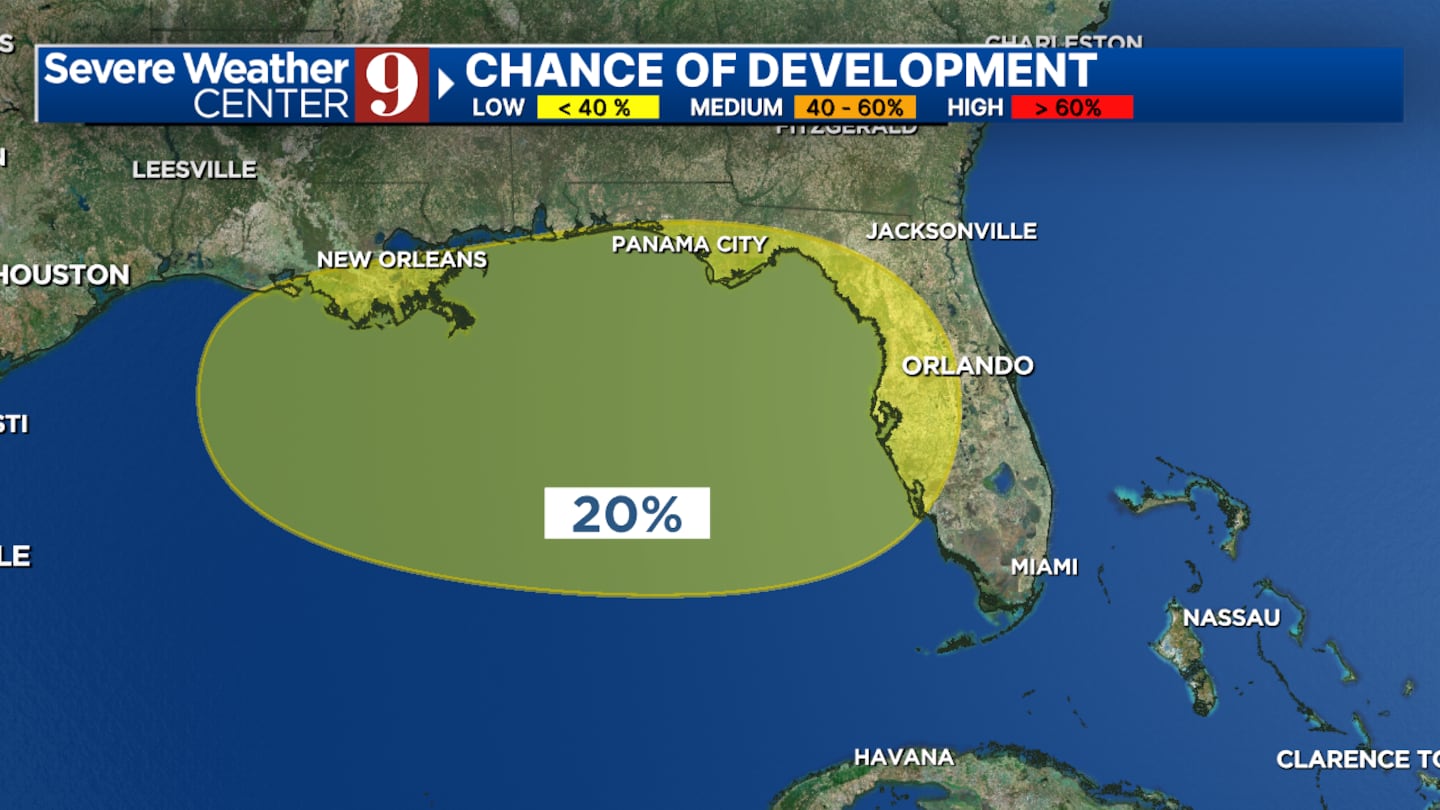
Every model that shows this storm developing has it becoming a tropical depression and moving towards Louisiana.
It is important to note we are seeing some moisture move into the area that will bring us heavier rain early this week but none of this is associated with any kind of tropical system yet.
As this disturbance tracks to the West it will take advantage of some warm water in the Gulf but it is still unlikely to fully develop into that next tropical system.
The main threats along the Gulf Coast particularly between Panama City and New Orleans will be localized flash flooding mid to late this upcoming week.
Click here to download our free news, weather and smart TV apps. And click here to stream Channel 9 Eyewitness News live.

©2025 Cox Media Group